North Prairie geodata
North Prairie (Wisconsin) is a populated place; located in United States in America/Chicago (GMT-5) time zone. With population of 2,158 people, there are 11446 cities with bigger population in this country. Compared to other cities in United States, 82.8% of cities are located further ↓South; 54.5% of cities are located further →East and 71.5% of cities have lower elevation than North Prairie. Note1
Administrative division(s):
- Level 1: Wisconsin
- Level 2: Waukesha County
- Level 3: Village of North Prairie


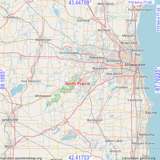
North Prairie GPS coordinates[2]
42° 56' 4.056" North, 88° 24' 19.332" West
| Map corner | latitude | longitude |
|---|---|---|
| Upper-left | 43.44709°, | -89.1085° |
| Center: | 42.93446°, | -88.40537° |
| Lower-right: | 42.41753°, | -87.70225° |
| Map W x H: | 114.5×114.5 km | = 71.1×71.1mi |
| max Lat: | 71.29058° ⇑17.2% North |
| North Prairie: | 42.93446° |
| min Lat: | ⇓82.8% South 19.06759° |
| min Long | North Prairie | max Long |
| -171.73463° | -88.40537° | -66.98998° |
| W 45.5%⇐ | ⇒54.5% E |
Elevation
Elevation of North Prairie is 293 m = 961 ft, and this is 1.8 m = 6 ft below average elevation for this country.
| Max E: |
3189 m = 10463 ft | 28.5% |
| Avg. | 294.8 m = 967 ft | |
| North Prairie | 293 m = 961 ft | |
Min E: |
-60 m = -197 ft | 71.5% |
See also: United States elevation on elevation.city.
Geographical zone
North Prairie is located in North temperate zone (between Tropic of Cancer and the Arctic Circle). Distance of this Northern Tropic circle is 2167.9 km =1347.1 mi to South.| Distance of | km | miles | from North Prairie |
|---|---|---|---|
| North Pole | 5233.2 | 3251.8 | to North |
| Arctic Circle | 2627.3 | 1632.5 | to North |
| Tropic Cancer | 2167.9 | 1347.1 | to South |
| Equator | 4773.9 | 2966.4 | to South |


Nearby cities:
15 places around North Prairie: (largest is in red/bold)
• Big Bend
17.2 km =10.7 mi,  110°
110°
• Delafield
14.1 km =8.8 mi,  0°
0°
• Dousman
10.4 km =6.5 mi,  328°
328°
• Eagle
8.3 km =5.2 mi,  222°
222°
• East Troy
16.6 km =10.3 mi,  179°
179°
• Hartland
19.6 km =12.2 mi,  15°
15°
• Mukwonago
9.5 km =5.9 mi,  142°
142°
• Nashotah
18.2 km =11.3 mi, 0°
• Oconomowoc Lake
19.4 km =12.1 mi,  346°
346°
• Palmyra
16 km =9.9 mi,  246°
246°
• Potter Lake
13.4 km =8.3 mi,  159°
159°
• Rome
19.1 km =11.9 mi,  285°
285°
• Sullivan
17.2 km =10.7 mi,  300°
300°
• Wales
8.1 km =5 mi, 16°
• Waukesha
16.5 km =10.3 mi,  58°
58°
Sources, notices
• [Note1] Compared only with cities in United States existing in our database
• [Src1] Map data: © OpenStreetMap contributors (CC-BY-SA)
• [Src2] Other city data from geonames.org with taken over terms of usage.
• [Src3] Geographical zone / Annual Mean Temperature by Robert A. Rohde @ Wikipedia
