Three Lakes geodata
Three Lakes (Wisconsin) is a populated place; located in United States in America/Chicago (GMT-5) time zone. With population of 605 people, there are 19636 cities with bigger population in this country. Compared to other cities in United States, 94.7% of cities are located further ↓South; 56.6% of cities are located further →East and 88% of cities have lower elevation than Three Lakes. Note1


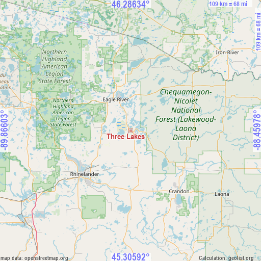
Three Lakes GPS coordinates[2]
45° 47' 53.844" North, 89° 9' 46.44" West
| Map corner | latitude | longitude |
|---|---|---|
| Upper-left | 46.28634°, | -89.86603° |
| Center: | 45.79829°, | -89.1629° |
| Lower-right: | 45.30592°, | -88.45978° |
| Map W x H: | 109×109 km | = 67.7×67.7mi |
| max Lat: | 71.29058° ⇑5.3% North |
| Three Lakes: | 45.79829° |
| min Lat: | ⇓94.7% South 19.06759° |
| min Long | Three Lakes | max Long |
| -171.73463° | -89.1629° | -66.98998° |
| W 43.4%⇐ | ⇒56.6% E |
Elevation
Elevation of Three Lakes is 507 m = 1663 ft, and this is 212.2 m = 696 ft above average elevation for this country.
| Max E: |
3189 m = 10463 ft | 12% |
| Three Lakes | 507 m 1663 ft | |
| Avg. | 294.8 m = 967 ft | |
Min E: |
-60 m = -197 ft | 88% |
See also: United States elevation on elevation.city.
Geographical zone
Three Lakes is located in North temperate zone (between Tropic of Cancer and the Arctic Circle). Distance of this North polar circle is 2308.9 km =1434.7 mi to North.| Distance of | km | miles | from Three Lakes |
|---|---|---|---|
| North Pole | 4914.8 | 3053.9 | to North |
| Arctic Circle | 2308.9 | 1434.7 | to North |
| Tropic Cancer | 2486.4 | 1545 | to South |
| Equator | 5092.3 | 3164.2 | to South |


Nearby cities:
15 places around Three Lakes: (largest is in red/bold)
• Antigo
73.2 km =45.5 mi,  179°
179°
• Caspian
50.5 km =31.4 mi,  54°
54°
• Crandon
32.3 km =20.1 mi,  141°
141°
• Crystal Falls
72.2 km =44.9 mi,  62°
62°
• Eagle River
14.6 km =9.1 mi,  334°
334°
• Florence
71.9 km =44.7 mi,  78°
78°
• Iron River
51.9 km =32.2 mi, 50°
• Lac du Flambeau
59.6 km =37 mi,  288°
288°
• Laona
46 km =28.6 mi,  124°
124°
• Nashville
32.5 km =20.2 mi,  160°
160°
• Rhinelander
26.4 km =16.4 mi,  227°
227°
• Stambaugh, Iron River
52 km =32.3 mi, 52°
• Tomahawk
57.2 km =35.5 mi, 230°
• Wabeno
55.9 km =34.7 mi, 135°
• Woodruff
42.9 km =26.7 mi,  284°
284°
Sources, notices
• [Note1] Compared only with cities in United States existing in our database
• [Src1] Map data: © OpenStreetMap contributors (CC-BY-SA)
• [Src2] Other city data from geonames.org with taken over terms of usage.
• [Src3] Geographical zone / Annual Mean Temperature by Robert A. Rohde @ Wikipedia
