Iron River geodata
Iron River (Michigan) is a seat of government of a political entity; located in United States in America/Menominee (GMT-5) time zone. With population of 2,904 people, there are 9793 cities with bigger population in this country. Compared to other cities in United States, 95.2% of cities are located further ↓South; 55.2% of cities are located further →East and 86.7% of cities have lower elevation than Iron River. Note1


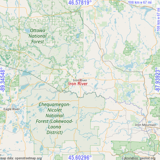
Iron River GPS coordinates[2]
46° 5' 33.828" North, 88° 38' 32.46" West
| Map corner | latitude | longitude |
|---|---|---|
| Upper-left | 46.57819°, | -89.34548° |
| Center: | 46.09273°, | -88.64235° |
| Lower-right: | 45.60296°, | -87.93923° |
| Map W x H: | 108.4×108.4 km | = 67.4×67.4mi |
| max Lat: | 71.29058° ⇑4.8% North |
| Iron River: | 46.09273° |
| min Lat: | ⇓95.2% South 19.06759° |
| min Long | Iron River | max Long |
| -171.73463° | -88.64235° | -66.98998° |
| W 44.8%⇐ | ⇒55.2% E |
Elevation
Elevation of Iron River is 458 m = 1503 ft, and this is 163.2 m = 535 ft above average elevation for this country.
| Max E: |
3189 m = 10463 ft | 13.3% |
| Iron River | 458 m 1503 ft | |
| Avg. | 294.8 m = 967 ft | |
Min E: |
-60 m = -197 ft | 86.7% |
See also: United States elevation on elevation.city.
Geographical zone
Iron River is located in North temperate zone (between Tropic of Cancer and the Arctic Circle). Distance of this North polar circle is 2276.1 km =1414.3 mi to North.| Distance of | km | miles | from Iron River |
|---|---|---|---|
| North Pole | 4882 | 3033.5 | to North |
| Arctic Circle | 2276.1 | 1414.3 | to North |
| Tropic Cancer | 2519.1 | 1565.3 | to South |
| Equator | 5125 | 3184.5 | to South |


Nearby cities:
15 places around Iron River: (largest is in red/bold)
• Caspian
3.2 km =2 mi,  166°
166°
• Crandon
61.3 km =38.1 mi,  199°
199°
• Crystal Falls
23.8 km =14.8 mi,  88°
88°
• Eagle River
50.4 km =31.3 mi,  247°
247°
• Florence
35.6 km =22.1 mi,  122°
122°
• Iron Mountain
53.9 km =33.5 mi, 124°
• Kingsford
55.1 km =34.2 mi,  126°
126°
• Laona
58.8 km =36.5 mi,  182°
182°
• Nashville
70 km =43.5 mi,  205°
205°
• Niagara
61.5 km =38.2 mi, 125°
• Norway
66.5 km =41.3 mi, 120°
• Quinnesec
59.7 km =37.1 mi, 122°
• Republic
62 km =38.5 mi,  55°
55°
• Stambaugh, Iron River
1.8 km =1.1 mi,  137°
137°
• Three Lakes
51.9 km =32.2 mi,  230°
230°
Sources, notices
• [Note1] Compared only with cities in United States existing in our database
• [Src1] Map data: © OpenStreetMap contributors (CC-BY-SA)
• [Src2] Other city data from geonames.org with taken over terms of usage.
• [Src3] Geographical zone / Annual Mean Temperature by Robert A. Rohde @ Wikipedia
