Willcox geodata
Willcox (Arizona) is a populated place; located in United States in America/Phoenix (GMT-7) time zone. With population of 3,552 people, there are 8793 cities with bigger population in this country. Compared to other cities in United States, 88% of cities are located further ↑North; 85.7% of cities are located further →East and 95.1% of cities have lower elevation than Willcox. Note1


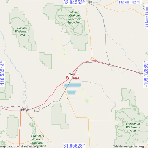
Willcox GPS coordinates[2]
32° 15' 10.26" North, 109° 49' 55.236" West
| Map corner | latitude | longitude |
|---|---|---|
| Upper-left | 32.84553°, | -110.53514° |
| Center: | 32.25285°, | -109.83201° |
| Lower-right: | 31.65628°, | -109.12889° |
| Map W x H: | 132.2×132.2 km | = 82.1×82.1mi |
| max Lat: | 71.29058° ⇑88% North |
| Willcox: | 32.25285° |
| min Lat: | ⇓12% South 19.06759° |
| min Long | Willcox | max Long |
| -171.73463° | -109.83201° | -66.98998° |
| W 14.3%⇐ | ⇒85.7% E |
Elevation
Elevation of Willcox is 1274 m = 4180 ft, and this is 979.2 m = 3213 ft above average elevation for this country.
| Max E: |
3189 m = 10463 ft | 4.9% |
| Willcox | 1274 m 4180 ft | |
| Avg. | 294.8 m = 967 ft | |
Min E: |
-60 m = -197 ft | 95.1% |
See also: United States elevation on elevation.city.
Geographical zone
Willcox is located in North temperate zone (between Tropic of Cancer and the Arctic Circle). Distance of this Northern Tropic circle is 980.3 km =609.1 mi to South.| Distance of | km | miles | from Willcox |
|---|---|---|---|
| North Pole | 6420.9 | 3989.8 | to North |
| Arctic Circle | 3815 | 2370.5 | to North |
| Tropic Cancer | 980.3 | 609.1 | to South |
| Equator | 3586.2 | 2228.4 | to South |


Nearby cities:
15 places around Willcox: (largest is in red/bold)
• Benson
53.9 km =33.5 mi,  233°
233°
• Cactus Flat
57.3 km =35.6 mi,  10°
10°
• Central
68.4 km =42.5 mi,  3°
3°
• Huachuca City
84.1 km =52.3 mi,  214°
214°
• Mescal
63.9 km =39.7 mi,  242°
242°
• Pima
71.6 km =44.5 mi, 0°
• Pimaco Two
67.4 km =41.9 mi, 240°
• Safford
65.7 km =40.8 mi, 10°
• Saint David
52.9 km =32.9 mi,  222°
222°
• San Jose
67 km =41.6 mi,  19°
19°
• Swift Trail Junction
54.2 km =33.7 mi, 11°
• Thatcher
66.7 km =41.4 mi, 5°
• Tombstone
64 km =39.8 mi,  200°
200°
• Whetstone
58.2 km =36.2 mi, 235°
• Whetstone
77.8 km =48.3 mi, 217°
Sources, notices
• [Note1] Compared only with cities in United States existing in our database
• [Src1] Map data: © OpenStreetMap contributors (CC-BY-SA)
• [Src2] Other city data from geonames.org with taken over terms of usage.
• [Src3] Geographical zone / Annual Mean Temperature by Robert A. Rohde @ Wikipedia
