Day Valley geodata
Day Valley (California) is a populated place; located in United States in America/Los_Angeles (GMT-7) time zone. With population of 3,409 people, there are 8981 cities with bigger population in this country. Compared to other cities in United States, 66% of cities are located further ↑North; 94.8% of cities are located further →East and 84.6% of cities have lower elevation than Day Valley. Note1


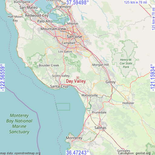
Day Valley GPS coordinates[2]
37° 2' 8.808" North, 121° 51' 44.856" West
| Map corner | latitude | longitude |
|---|---|---|
| Upper-left | 37.59498°, | -122.56559° |
| Center: | 37.03578°, | -121.86246° |
| Lower-right: | 36.47243°, | -121.15934° |
| Map W x H: | 124.8×124.8 km | = 77.5×77.5mi |
| max Lat: | 71.29058° ⇑66% North |
| Day Valley: | 37.03578° |
| min Lat: | ⇓34% South 19.06759° |
| min Long | Day Valley | max Long |
| -171.73463° | -121.86246° | -66.98998° |
| W 5.2%⇐ | ⇒94.8% E |
Elevation
Elevation of Day Valley is 415 m = 1362 ft, and this is 120.2 m = 394 ft above average elevation for this country.
| Max E: |
3189 m = 10463 ft | 15.4% |
| Day Valley | 415 m 1362 ft | |
| Avg. | 294.8 m = 967 ft | |
Min E: |
-60 m = -197 ft | 84.6% |
See also: United States elevation on elevation.city.
Geographical zone
Day Valley is located in North temperate zone (between Tropic of Cancer and the Arctic Circle). Distance of this Northern Tropic circle is 1512.1 km =939.6 mi to South.| Distance of | km | miles | from Day Valley |
|---|---|---|---|
| North Pole | 5889.1 | 3659.3 | to North |
| Arctic Circle | 3283.2 | 2040.1 | to North |
| Tropic Cancer | 1512.1 | 939.6 | to South |
| Equator | 4118 | 2558.8 | to South |


Nearby cities:
15 places around Day Valley: (largest is in red/bold)
• Amesti
10.9 km =6.8 mi,  137°
137°
• Aptos
7.3 km =4.5 mi,  206°
206°
• Aptos Hills-Larkin Valley
8.7 km =5.4 mi,  163°
163°
• Capitola
10.5 km =6.5 mi,  230°
230°
• Corralitos
7.2 km =4.5 mi, 136°
• Freedom
13.7 km =8.5 mi, 144°
• Interlaken
14.8 km =9.2 mi,  129°
129°
• La Selva Beach
11 km =6.8 mi,  181°
181°
• Live Oak
12 km =7.5 mi,  241°
241°
• Opal Cliffs
12.3 km =7.6 mi, 227°
• Rio Del Mar
8.2 km =5.1 mi,  204°
204°
• Scotts Valley
13.6 km =8.5 mi,  277°
277°
• Seacliff
8.3 km =5.2 mi, 214°
• Soquel
9.9 km =6.2 mi, 237°
• Twin Lakes
14.2 km =8.8 mi, 237°
Sources, notices
• [Note1] Compared only with cities in United States existing in our database
• [Src1] Map data: © OpenStreetMap contributors (CC-BY-SA)
• [Src2] Other city data from geonames.org with taken over terms of usage.
• [Src3] Geographical zone / Annual Mean Temperature by Robert A. Rohde @ Wikipedia
