Jamestown geodata
Jamestown (California) is a populated place; located in United States in America/Los_Angeles (GMT-7) time zone. With population of 3,433 people, there are 8936 cities with bigger population in this country. Compared to other cities in United States, 61.9% of cities are located further ↑North; 93.2% of cities are located further →East and 85.3% of cities have lower elevation than Jamestown. Note1


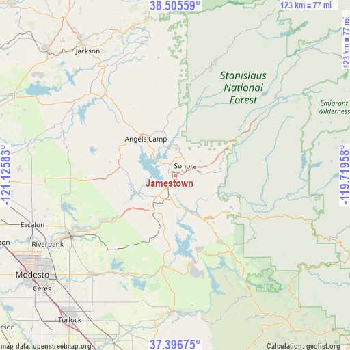
Jamestown GPS coordinates[2]
37° 57' 11.736" North, 120° 25' 21.72" West
| Map corner | latitude | longitude |
|---|---|---|
| Upper-left | 38.50559°, | -121.12583° |
| Center: | 37.95326°, | -120.4227° |
| Lower-right: | 37.39675°, | -119.71958° |
| Map W x H: | 123.3×123.3 km | = 76.6×76.6mi |
| max Lat: | 71.29058° ⇑61.9% North |
| Jamestown: | 37.95326° |
| min Lat: | ⇓38.1% South 19.06759° |
| min Long | Jamestown | max Long |
| -171.73463° | -120.4227° | -66.98998° |
| W 6.8%⇐ | ⇒93.2% E |
Elevation
Elevation of Jamestown is 430 m = 1411 ft, and this is 135.2 m = 444 ft above average elevation for this country.
| Max E: |
3189 m = 10463 ft | 14.7% |
| Jamestown | 430 m 1411 ft | |
| Avg. | 294.8 m = 967 ft | |
Min E: |
-60 m = -197 ft | 85.3% |
See also: United States elevation on elevation.city.
Geographical zone
Jamestown is located in North temperate zone (between Tropic of Cancer and the Arctic Circle). Distance of this Northern Tropic circle is 1614.1 km =1003 mi to South.| Distance of | km | miles | from Jamestown |
|---|---|---|---|
| North Pole | 5787.1 | 3595.9 | to North |
| Arctic Circle | 3181.2 | 1976.7 | to North |
| Tropic Cancer | 1614.1 | 1003 | to South |
| Equator | 4220 | 2622.2 | to South |


Nearby cities:
15 places around Jamestown: (largest is in red/bold)
• Angels Camp
16.4 km =10.2 mi,  321°
321°
• Cedar Ridge
17.9 km =11.1 mi,  45°
45°
• Columbia
9.4 km =5.8 mi,  11°
11°
• Copperopolis
19.5 km =12.1 mi,  279°
279°
• East Sonora
6 km =3.7 mi,  63°
63°
• Forest Meadows
24 km =14.9 mi,  3°
3°
• Groveland
21 km =13 mi,  127°
127°
• Mono Vista
14.3 km =8.9 mi,  69°
69°
• Murphys
20.8 km =12.9 mi,  350°
350°
• Phoenix Lake
11.7 km =7.3 mi, 59°
• Sonora
4.9 km =3 mi, 46°
• Soulsbyville
14.4 km =8.9 mi,  75°
75°
• Tuolumne City
15.9 km =9.9 mi,  86°
86°
• Tuttletown
5.4 km =3.4 mi, 322°
• Twain Harte
19.2 km =11.9 mi, 60°
Sources, notices
• [Note1] Compared only with cities in United States existing in our database
• [Src1] Map data: © OpenStreetMap contributors (CC-BY-SA)
• [Src2] Other city data from geonames.org with taken over terms of usage.
• [Src3] Geographical zone / Annual Mean Temperature by Robert A. Rohde @ Wikipedia
