Lamar geodata
Lamar (Colorado) is a seat of a second-order administrative division; located in United States in America/Denver (GMT-6) time zone. With population of 7,555 people, there are 5510 cities with bigger population in this country. Compared to other cities in United States, 61.1% of cities are located further ↑North; 82.1% of cities are located further →East and 94.1% of cities have lower elevation than Lamar. Note1


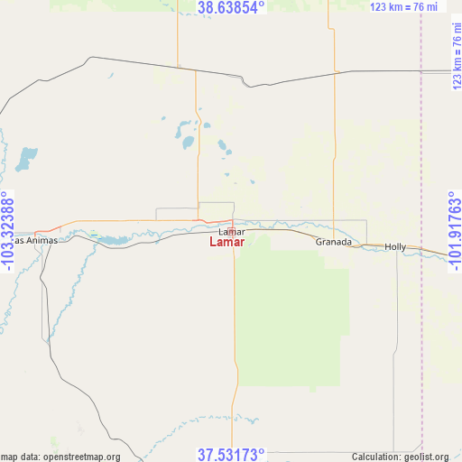
Lamar GPS coordinates[2]
38° 5' 14.028" North, 102° 37' 14.7" West
| Map corner | latitude | longitude |
|---|---|---|
| Upper-left | 38.63854°, | -103.32388° |
| Center: | 38.08723°, | -102.62075° |
| Lower-right: | 37.53173°, | -101.91763° |
| Map W x H: | 123.1×123.1 km | = 76.5×76.5mi |
| max Lat: | 71.29058° ⇑61.1% North |
| Lamar: | 38.08723° |
| min Lat: | ⇓38.9% South 19.06759° |
| min Long | Lamar | max Long |
| -171.73463° | -102.62075° | -66.98998° |
| W 17.9%⇐ | ⇒82.1% E |
Elevation
Elevation of Lamar is 1107 m = 3632 ft, and this is 812.2 m = 2665 ft above average elevation for this country.
| Max E: |
3189 m = 10463 ft | 5.9% |
| Lamar | 1107 m 3632 ft | |
| Avg. | 294.8 m = 967 ft | |
Min E: |
-60 m = -197 ft | 94.1% |
See also: United States elevation on elevation.city.
Geographical zone
Lamar is located in North temperate zone (between Tropic of Cancer and the Arctic Circle). Distance of this Northern Tropic circle is 1629 km =1012.2 mi to South.| Distance of | km | miles | from Lamar |
|---|---|---|---|
| North Pole | 5772.2 | 3586.7 | to North |
| Arctic Circle | 3166.3 | 1967.4 | to North |
| Tropic Cancer | 1629 | 1012.2 | to South |
| Equator | 4234.9 | 2631.4 | to South |


Nearby cities:
15 places around Lamar: (largest is in red/bold)
• Cheyenne Wells
84.9 km =52.8 mi,  15°
15°
• Eads
45.9 km =28.5 mi,  342°
342°
• Holly
43.8 km =27.2 mi,  95°
95°
• Johnson
95.6 km =59.4 mi,  126°
126°
• La Junta
81.6 km =50.7 mi,  261°
261°
• Las Animas
52.7 km =32.7 mi,  267°
267°
• North La Junta
80.4 km =50 mi, 262°
• Ordway
100.3 km =62.3 mi,  278°
278°
• Rocky Ford
96.3 km =59.8 mi, 267°
• Sharon Springs
117.6 km =73.1 mi,  39°
39°
• Springfield
75.5 km =46.9 mi,  179°
179°
• Swink
88.6 km =55.1 mi, 264°
• Syracuse
76.8 km =47.7 mi, 98°
• Tribune
86.9 km =54 mi,  60°
60°
• Walsh
83.6 km =51.9 mi,  158°
158°
Sources, notices
• [Note1] Compared only with cities in United States existing in our database
• [Src1] Map data: © OpenStreetMap contributors (CC-BY-SA)
• [Src2] Other city data from geonames.org with taken over terms of usage.
• [Src3] Geographical zone / Annual Mean Temperature by Robert A. Rohde @ Wikipedia
