Tyrone geodata
Tyrone (New Mexico) is a populated place; located in United States in America/Denver (GMT-6) time zone. With population of 637 people, there are 19293 cities with bigger population in this country. Compared to other cities in United States, 86.4% of cities are located further ↑North; 85.1% of cities are located further →East and 98.2% of cities have lower elevation than Tyrone. Note1


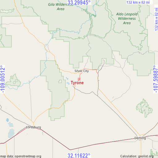
Tyrone GPS coordinates[2]
32° 42' 35.28" North, 108° 18' 7.164" West
| Map corner | latitude | longitude |
|---|---|---|
| Upper-left | 33.29945°, | -109.00512° |
| Center: | 32.7098°, | -108.30199° |
| Lower-right: | 32.11622°, | -107.59887° |
| Map W x H: | 131.6×131.6 km | = 81.8×81.8mi |
| max Lat: | 71.29058° ⇑86.4% North |
| Tyrone: | 32.7098° |
| min Lat: | ⇓13.6% South 19.06759° |
| min Long | Tyrone | max Long |
| -171.73463° | -108.30199° | -66.98998° |
| W 14.9%⇐ | ⇒85.1% E |
Elevation
Elevation of Tyrone is 1753 m = 5751 ft, and this is 1458.2 m = 4784 ft above average elevation for this country.
| Max E: |
3189 m = 10463 ft | 1.8% |
| Tyrone | 1753 m 5751 ft | |
| Avg. | 294.8 m = 967 ft | |
Min E: |
-60 m = -197 ft | 98.2% |
See also: United States elevation on elevation.city.
Geographical zone
Tyrone is located in North temperate zone (between Tropic of Cancer and the Arctic Circle). Distance of this Northern Tropic circle is 1031.1 km =640.7 mi to South.| Distance of | km | miles | from Tyrone |
|---|---|---|---|
| North Pole | 6370.1 | 3958.2 | to North |
| Arctic Circle | 3764.2 | 2339 | to North |
| Tropic Cancer | 1031.1 | 640.7 | to South |
| Equator | 3637 | 2259.9 | to South |


Nearby cities:
15 places around Tyrone: (largest is in red/bold)
• Arenas Valley
14.5 km =9 mi,  49°
49°
• Bayard
17 km =10.6 mi,  70°
70°
• Clifton
100.3 km =62.3 mi,  292°
292°
• Deming
70.7 km =43.9 mi,  133°
133°
• Duncan
75.2 km =46.7 mi,  270°
270°
• Hurley
15.9 km =9.9 mi,  94°
94°
• Keeler Farm
67.1 km =41.7 mi, 130°
• La Hacienda
77.9 km =48.4 mi,  135°
135°
• Lordsburg
55.2 km =34.3 mi,  223°
223°
• Mimbres
34.2 km =21.3 mi,  61°
61°
• Placitas
106.2 km =66 mi, 92°
• Salem
101.9 km =63.3 mi, 90°
• Santa Clara
16.2 km =10.1 mi, 61°
• Silver City
7 km =4.3 mi,  16°
16°
• York
86.6 km =53.8 mi,  283°
283°
Sources, notices
• [Note1] Compared only with cities in United States existing in our database
• [Src1] Map data: © OpenStreetMap contributors (CC-BY-SA)
• [Src2] Other city data from geonames.org with taken over terms of usage.
• [Src3] Geographical zone / Annual Mean Temperature by Robert A. Rohde @ Wikipedia
