Roseburg geodata
Roseburg (Oregon) is a seat of a second-order administrative division; located in United States in America/Los_Angeles (GMT-7) time zone. With population of 22,114 people, there are 2286 cities with bigger population in this country. Compared to other cities in United States, 84.9% of cities are located further ↓South; 98.2% of cities are located further →East and 61.7% of cities have higher elevation than Roseburg. Note1


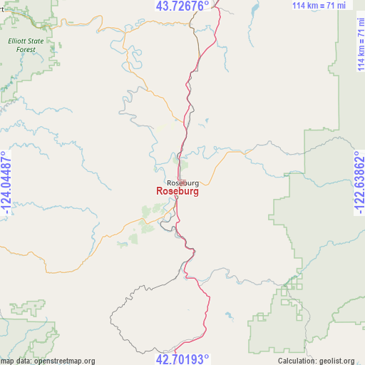
Roseburg GPS coordinates[2]
43° 12' 59.4" North, 123° 20' 30.264" West
| Map corner | latitude | longitude |
|---|---|---|
| Upper-left | 43.72676°, | -124.04487° |
| Center: | 43.2165°, | -123.34174° |
| Lower-right: | 42.70193°, | -122.63862° |
| Map W x H: | 114×113.9 km | = 70.8×70.8mi |
| max Lat: | 71.29058° ⇑15.1% North |
| Roseburg: | 43.2165° |
| min Lat: | ⇓84.9% South 19.06759° |
| min Long | Roseburg | max Long |
| -171.73463° | -123.34174° | -66.98998° |
| W 1.8%⇐ | ⇒98.2% E |
Elevation
Elevation of Roseburg is 146 m = 479 ft, and this is 148.8 m = 488 ft below average elevation for this country.
| Max E: |
3189 m = 10463 ft | 61.7% |
| Avg. | 294.8 m = 967 ft | |
| Roseburg | 146 m = 479 ft | |
Min E: |
-60 m = -197 ft | 38.3% |
See also: United States elevation on elevation.city.
Geographical zone
Roseburg is located in North temperate zone (between Tropic of Cancer and the Arctic Circle). Distance of this Northern Tropic circle is 2199.3 km =1366.6 mi to South.| Distance of | km | miles | from Roseburg |
|---|---|---|---|
| North Pole | 5201.8 | 3232.2 | to North |
| Arctic Circle | 2595.9 | 1613 | to North |
| Tropic Cancer | 2199.3 | 1366.6 | to South |
| Equator | 4805.2 | 2985.8 | to South |


Nearby cities:
15 places around Roseburg: (largest is in red/bold)
• Canyonville
32.5 km =20.2 mi,  171°
171°
• Drain
49.2 km =30.6 mi,  2°
2°
• Glendale
53.8 km =33.4 mi,  187°
187°
• Glide
21.7 km =13.5 mi,  64°
64°
• Green
6.6 km =4.1 mi,  198°
198°
• Lookingglass
12.4 km =7.7 mi,  250°
250°
• Melrose
10.1 km =6.3 mi,  290°
290°
• Myrtle Creek
22.2 km =13.8 mi, 169°
• Oakland
23.1 km =14.4 mi,  8°
8°
• Riddle
29.6 km =18.4 mi,  183°
183°
• Roseburg North
6.2 km =3.9 mi,  30°
30°
• Sutherlin
19.4 km =12.1 mi, 6°
• Tri-City
25.9 km =16.1 mi, 174°
• Winston
11.9 km =7.4 mi,  208°
208°
• Yoncalla
42.7 km =26.5 mi, 6°
Sources, notices
• [Note1] Compared only with cities in United States existing in our database
• [Src1] Map data: © OpenStreetMap contributors (CC-BY-SA)
• [Src2] Other city data from geonames.org with taken over terms of usage.
• [Src3] Geographical zone / Annual Mean Temperature by Robert A. Rohde @ Wikipedia
