Elk Ridge geodata
Elk Ridge (Utah) is a populated place; located in United States in America/Denver (GMT-6) time zone. With population of 3,183 people, there are 9328 cities with bigger population in this country. Compared to other cities in United States, 53.7% of cities are located further ↓South; 86.8% of cities are located further →East and 97.6% of cities have lower elevation than Elk Ridge. Note1


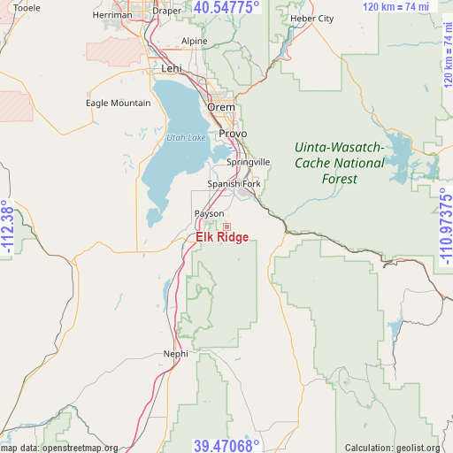
Elk Ridge GPS coordinates[2]
40° 0' 40.824" North, 111° 40' 36.732" West
| Map corner | latitude | longitude |
|---|---|---|
| Upper-left | 40.54775°, | -112.38° |
| Center: | 40.01134°, | -111.67687° |
| Lower-right: | 39.47068°, | -110.97375° |
| Map W x H: | 119.8×119.8 km | = 74.4×74.4mi |
| max Lat: | 71.29058° ⇑46.3% North |
| Elk Ridge: | 40.01134° |
| min Lat: | ⇓53.7% South 19.06759° |
| min Long | Elk Ridge | max Long |
| -171.73463° | -111.67687° | -66.98998° |
| W 13.2%⇐ | ⇒86.8% E |
Elevation
Elevation of Elk Ridge is 1635 m = 5364 ft, and this is 1340.2 m = 4397 ft above average elevation for this country.
| Max E: |
3189 m = 10463 ft | 2.4% |
| Elk Ridge | 1635 m 5364 ft | |
| Avg. | 294.8 m = 967 ft | |
Min E: |
-60 m = -197 ft | 97.6% |
See also: United States elevation on elevation.city.
Geographical zone
Elk Ridge is located in North temperate zone (between Tropic of Cancer and the Arctic Circle). Distance of this Northern Tropic circle is 1842.9 km =1145.1 mi to South.| Distance of | km | miles | from Elk Ridge |
|---|---|---|---|
| North Pole | 5558.2 | 3453.7 | to North |
| Arctic Circle | 2952.3 | 1834.5 | to North |
| Tropic Cancer | 1842.9 | 1145.1 | to South |
| Equator | 4448.8 | 2764.4 | to South |


Nearby cities:
15 places around Elk Ridge: (largest is in red/bold)
• Benjamin
10.7 km =6.6 mi,  334°
334°
• Genola
14.3 km =8.9 mi,  263°
263°
• Goshen
20.1 km =12.5 mi,  251°
251°
• Lake Shore
13.1 km =8.1 mi,  339°
339°
• Mapleton
15.6 km =9.7 mi,  32°
32°
• Mona
26.5 km =16.5 mi,  215°
215°
• Payson
6 km =3.7 mi,  307°
307°
• Provo
24.8 km =15.4 mi,  3°
3°
• Rocky Ridge
16 km =9.9 mi,  233°
233°
• Salem
4.6 km =2.9 mi, 3°
• Santaquin
10.1 km =6.3 mi, 246°
• Spanish Fork
11.7 km =7.3 mi,  9°
9°
• Springville
18 km =11.2 mi,  18°
18°
• West Mountain
11 km =6.8 mi,  300°
300°
• Woodland Hills
2.4 km =1.5 mi,  79°
79°
Sources, notices
• [Note1] Compared only with cities in United States existing in our database
• [Src1] Map data: © OpenStreetMap contributors (CC-BY-SA)
• [Src2] Other city data from geonames.org with taken over terms of usage.
• [Src3] Geographical zone / Annual Mean Temperature by Robert A. Rohde @ Wikipedia
