Randolph geodata
Randolph (Utah) is a seat of a second-order administrative division; located in United States in America/Denver (GMT-6) time zone. With population of 462 people, there are 20917 cities with bigger population in this country. Compared to other cities in United States, 72.5% of cities are located further ↓South; 86.4% of cities are located further →East and 98.8% of cities have lower elevation than Randolph. Note1


Randolph GPS coordinates[2]
41° 39' 56.808" North, 111° 10' 55.704" West
| Map corner | latitude | longitude |
|---|---|---|
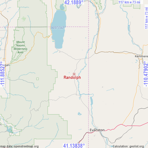
| Upper-left | 42.1889°, | -111.88527° |
| Center: | 41.66578°, | -111.18214° |
| Lower-right: | 41.13838°, | -110.47902° |
| Map W x H: | 116.8×116.8 km | = 72.6×72.6mi |
| max Lat: | 71.29058° ⇑27.5% North |
| Randolph: | 41.66578° |
| min Lat: | ⇓72.5% South 19.06759° |
| min Long | Randolph | max Long |
| -171.73463° | -111.18214° | -66.98998° |
| W 13.6%⇐ | ⇒86.4% E |
Elevation
Elevation of Randolph is 1918 m = 6293 ft, and this is 1623.2 m = 5325 ft above average elevation for this country.
| Max E: |
3189 m = 10463 ft | 1.2% |
| Randolph | 1918 m 6293 ft | |
| Avg. | 294.8 m = 967 ft | |
Min E: |
-60 m = -197 ft | 98.8% |
See also: United States elevation on elevation.city.
Geographical zone
Randolph is located in North temperate zone (between Tropic of Cancer and the Arctic Circle). Distance of this Northern Tropic circle is 2026.9 km =1259.5 mi to South.| Distance of | km | miles | from Randolph |
|---|---|---|---|
| North Pole | 5374.3 | 3339.4 | to North |
| Arctic Circle | 2768.4 | 1720.2 | to North |
| Tropic Cancer | 2026.9 | 1259.5 | to South |
| Equator | 4632.8 | 2878.7 | to South |


Nearby cities:
15 places around Randolph: (largest is in red/bold)
• Bear River
33.9 km =21.1 mi,  157°
157°
• Cokeville
50 km =31.1 mi,  22°
22°
• Diamondville
54.9 km =34.1 mi,  76°
76°
• Evanston
47.8 km =29.7 mi, 157°
• Garden City
35.8 km =22.2 mi,  330°
330°
• Hyde Park
54.9 km =34.1 mi,  285°
285°
• Hyrum
55.8 km =34.7 mi,  266°
266°
• Kemmerer
55.3 km =34.4 mi, 75°
• Logan
54.7 km =34 mi,  278°
278°
• Millville
53.3 km =33.1 mi, 271°
• Nibley
54.1 km =33.6 mi, 271°
• North Logan
52.9 km =32.9 mi, 282°
• Paradise
55.6 km =34.5 mi,  258°
258°
• Providence
52.9 km =32.9 mi, 274°
• River Heights
53.4 km =33.2 mi, 276°
Sources, notices
• [Note1] Compared only with cities in United States existing in our database
• [Src1] Map data: © OpenStreetMap contributors (CC-BY-SA)
• [Src2] Other city data from geonames.org with taken over terms of usage.
• [Src3] Geographical zone / Annual Mean Temperature by Robert A. Rohde @ Wikipedia
