Enetai geodata
Enetai (Washington) is a populated place; located in United States in America/Los_Angeles (GMT-7) time zone. With population of 2,286 people, there are 11118 cities with bigger population in this country. Compared to other cities in United States, 97.8% of cities are located further ↓South; 96.9% of cities are located further →East and 82.3% of cities have higher elevation than Enetai. Note1


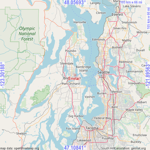
Enetai GPS coordinates[2]
47° 35' 5.352" North, 122° 35' 55.5" West
| Map corner | latitude | longitude |
|---|---|---|
| Upper-left | 48.05693°, | -123.30188° |
| Center: | 47.58482°, | -122.59875° |
| Lower-right: | 47.10841°, | -121.89563° |
| Map W x H: | 105.5×105.5 km | = 65.6×65.6mi |
| max Lat: | 71.29058° ⇑2.2% North |
| Enetai: | 47.58482° |
| min Lat: | ⇓97.8% South 19.06759° |
| min Long | Enetai | max Long |
| -171.73463° | -122.59875° | -66.98998° |
| W 3.1%⇐ | ⇒96.9% E |
Elevation
Elevation of Enetai is 37 m = 121 ft, and this is 257.8 m = 846 ft below average elevation for this country.
| Max E: |
3189 m = 10463 ft | 82.3% |
| Avg. | 294.8 m = 967 ft | |
| Enetai | 37 m = 121 ft | |
Min E: |
-60 m = -197 ft | 17.7% |
See also: United States elevation on elevation.city.
Geographical zone
Enetai is located in North temperate zone (between Tropic of Cancer and the Arctic Circle). Distance of this North polar circle is 2110.2 km =1311.2 mi to North.| Distance of | km | miles | from Enetai |
|---|---|---|---|
| North Pole | 4716.1 | 2930.4 | to North |
| Arctic Circle | 2110.2 | 1311.2 | to North |
| Tropic Cancer | 2685 | 1668.4 | to South |
| Equator | 5290.9 | 3287.6 | to South |


Nearby cities:
15 places around Enetai: (largest is in red/bold)
• Bainbridge Island
7.4 km =4.6 mi,  51°
51°
• Bethel
10.4 km =6.5 mi,  193°
193°
• Bremerton
3.2 km =2 mi,  232°
232°
• Chico
8.9 km =5.5 mi,  289°
289°
• East Port Orchard
7.1 km =4.4 mi,  195°
195°
• Erlands Point-Kitsap Lake
7.9 km =4.9 mi,  280°
280°
• Gorst
10.3 km =6.4 mi, 230°
• Manchester
5.2 km =3.2 mi,  128°
128°
• Navy Yard City
6 km =3.7 mi, 234°
• Parkwood
5.8 km =3.6 mi, 188°
• Port Orchard
5.7 km =3.5 mi,  209°
209°
• Rocky Point
5.3 km =3.3 mi, 279°
• Silverdale
9.8 km =6.1 mi,  312°
312°
• Southworth
10.9 km =6.8 mi,  138°
138°
• Tracyton
5 km =3.1 mi,  302°
302°
Sources, notices
• [Note1] Compared only with cities in United States existing in our database
• [Src1] Map data: © OpenStreetMap contributors (CC-BY-SA)
• [Src2] Other city data from geonames.org with taken over terms of usage.
• [Src3] Geographical zone / Annual Mean Temperature by Robert A. Rohde @ Wikipedia
