Erlands Point-Kitsap Lake geodata
Erlands Point-Kitsap Lake (Washington) is a populated place; located in United States in America/Los_Angeles (GMT-7) time zone. With population of 2,935 people, there are 9742 cities with bigger population in this country. Compared to other cities in United States, 97.9% of cities are located further ↓South; 97.2% of cities are located further →East and 90% of cities have higher elevation than Erlands Point-Kitsap Lake. Note1
Current local time in Erlands Point-Kitsap Lake:
04:28 AM, FridayDifference from your time zone: hours


Erlands Point-Kitsap Lake GPS coordinates[2]
47° 35' 49.884" North, 122° 42' 8.1" West
| Map corner | latitude | longitude |
|---|---|---|
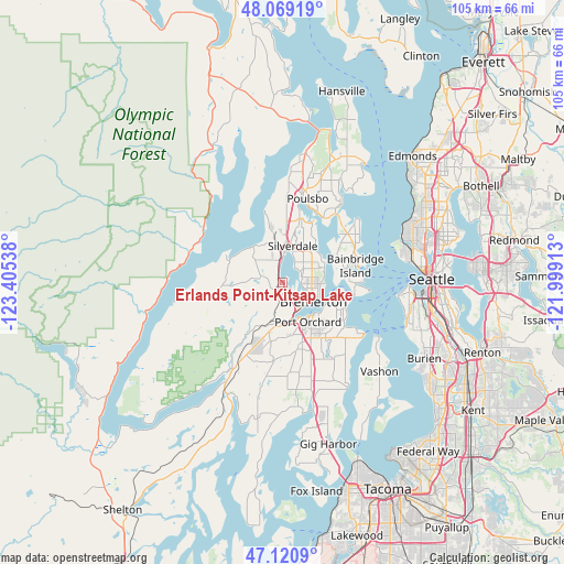
| Upper-left | 48.06919°, | -123.40538° |
| Center: | 47.59719°, | -122.70225° |
| Lower-right: | 47.1209°, | -121.99913° |
| Map W x H: | 105.4×105.4 km | = 65.5×65.5mi |
| max Lat: | 71.29058° ⇑2.1% North |
| Erlands Point-Kitsap Lake: | 47.59719° |
| min Lat: | ⇓97.9% South 19.06759° |
| min Long | Erlands Point-K | max Long |
| -171.73463° | -122.70225° | -66.98998° |
| W 2.8%⇐ | ⇒97.2% E |
Elevation
Elevation of Erlands Point-Kitsap Lake is 16 m = 52 ft, and this is 278.8 m = 915 ft below average elevation for this country.
| Max E: |
3189 m = 10463 ft | 90% |
| Avg. | 294.8 m = 967 ft | |
| Erlands Point-Kitsap Lake | 16 m = 52 ft | |
Min E: |
-60 m = -197 ft | 10% |
See also: United States elevation on elevation.city.
Geographical zone
Erlands Point-Kitsap Lake is located in North temperate zone (between Tropic of Cancer and the Arctic Circle). Distance of this North polar circle is 2108.9 km =1310.4 mi to North.| Distance of | km | miles | from Erlands Point-Kitsap Lake |
|---|---|---|---|
| North Pole | 4714.8 | 2929.6 | to North |
| Arctic Circle | 2108.9 | 1310.4 | to North |
| Tropic Cancer | 2686.4 | 1669.3 | to South |
| Equator | 5292.3 | 3288.5 | to South |


Nearby cities:
15 places around Erlands Point-Kitsap Lake: (largest is in red/bold)
• Bethel
12.7 km =7.9 mi,  155°
155°
• Bremerton
6.2 km =3.9 mi,  122°
122°
• Chico
1.7 km =1.1 mi,  338°
338°
• East Port Orchard
10.1 km =6.3 mi,  144°
144°
• Enetai
7.9 km =4.9 mi,  100°
100°
• Gorst
8 km =5 mi,  181°
181°
• Keyport
13.2 km =8.2 mi,  27°
27°
• Manchester
12.7 km =7.9 mi,  111°
111°
• Navy Yard City
5.6 km =3.5 mi,  149°
149°
• Parkwood
9.9 km =6.2 mi, 135°
• Port Orchard
8 km =5 mi, 141°
• Rocky Point
2.6 km =1.6 mi, 100°
• Seabeck
10.6 km =6.6 mi,  296°
296°
• Silverdale
5.3 km =3.3 mi,  5°
5°
• Tracyton
3.8 km =2.4 mi,  69°
69°
Sources, notices
• [Note1] Compared only with cities in United States existing in our database
• [Src1] Map data: © OpenStreetMap contributors (CC-BY-SA)
• [Src2] Other city data from geonames.org with taken over terms of usage.
• [Src3] Geographical zone / Annual Mean Temperature by Robert A. Rohde @ Wikipedia
