Key Center geodata
Key Center (Washington) is a populated place; located in United States in America/Los_Angeles (GMT-7) time zone. With population of 3,692 people, there are 8603 cities with bigger population in this country. Compared to other cities in United States, 97.3% of cities are located further ↓South; 97.3% of cities are located further →East and 78.2% of cities have higher elevation than Key Center. Note1


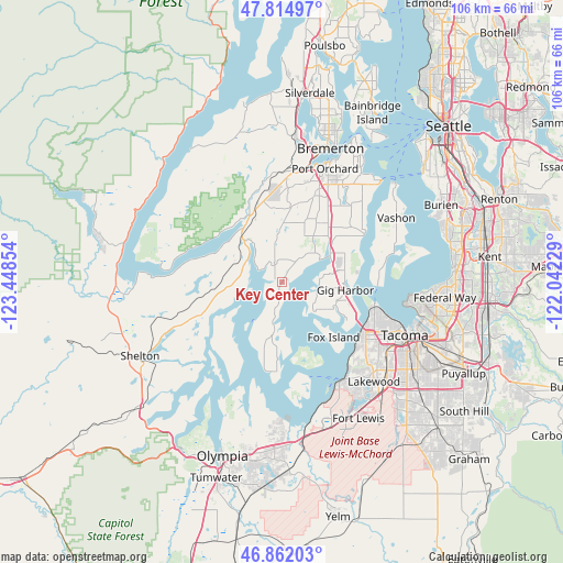
Key Center GPS coordinates[2]
47° 20' 26.34" North, 122° 44' 43.476" West
| Map corner | latitude | longitude |
|---|---|---|
| Upper-left | 47.81497°, | -123.44854° |
| Center: | 47.34065°, | -122.74541° |
| Lower-right: | 46.86203°, | -122.04229° |
| Map W x H: | 106×106 km | = 65.9×65.9mi |
| max Lat: | 71.29058° ⇑2.7% North |
| Key Center: | 47.34065° |
| min Lat: | ⇓97.3% South 19.06759° |
| min Long | Key Center | max Long |
| -171.73463° | -122.74541° | -66.98998° |
| W 2.7%⇐ | ⇒97.3% E |
Elevation
Elevation of Key Center is 55 m = 180 ft, and this is 239.8 m = 787 ft below average elevation for this country.
| Max E: |
3189 m = 10463 ft | 78.2% |
| Avg. | 294.8 m = 967 ft | |
| Key Center | 55 m = 180 ft | |
Min E: |
-60 m = -197 ft | 21.8% |
See also: United States elevation on elevation.city.
Geographical zone
Key Center is located in North temperate zone (between Tropic of Cancer and the Arctic Circle). Distance of this North polar circle is 2137.4 km =1328.1 mi to North.| Distance of | km | miles | from Key Center |
|---|---|---|---|
| North Pole | 4743.3 | 2947.3 | to North |
| Arctic Circle | 2137.4 | 1328.1 | to North |
| Tropic Cancer | 2657.9 | 1651.5 | to South |
| Equator | 5263.8 | 3270.8 | to South |


Nearby cities:
15 places around Key Center: (largest is in red/bold)
• Allyn
8 km =5 mi,  308°
308°
• Artondale
10.5 km =6.5 mi,  115°
115°
• Belfair
13.7 km =8.5 mi,  333°
333°
• Burley
12.2 km =7.6 mi,  45°
45°
• Canterwood
12.4 km =7.7 mi,  71°
71°
• Fox Island
13.2 km =8.2 mi,  138°
138°
• Gig Harbor
12.5 km =7.8 mi,  95°
95°
• Grapeview
6.8 km =4.2 mi,  261°
261°
• Home
7.4 km =4.6 mi,  190°
190°
• Longbranch
14.7 km =9.1 mi,  183°
183°
• Purdy
10.5 km =6.5 mi,  59°
59°
• Rosedale
7.1 km =4.4 mi, 98°
• Vaughn
1.4 km =0.9 mi,  286°
286°
• Wauna
8.8 km =5.5 mi, 61°
• Wollochet
14.6 km =9.1 mi, 123°
Sources, notices
• [Note1] Compared only with cities in United States existing in our database
• [Src1] Map data: © OpenStreetMap contributors (CC-BY-SA)
• [Src2] Other city data from geonames.org with taken over terms of usage.
• [Src3] Geographical zone / Annual Mean Temperature by Robert A. Rohde @ Wikipedia
