Kapa‘a geodata
Kapa‘a (Hawaii) is a populated place; located in United States in Pacific/Honolulu (GMT-10) time zone. With population of 10,699 people, there are 4269 cities with bigger population in this country. Compared to other cities in United States, 99.4% of cities are located further ↑North; 99.7% of cities are located further →East and 99.1% of cities have higher elevation than Kapa‘a. Note1


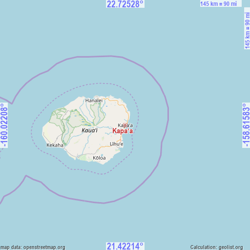
Kapa‘a GPS coordinates[2]
22° 4' 30.756" North, 159° 19' 8.22" West
| Map corner | latitude | longitude |
|---|---|---|
| Upper-left | 22.72528°, | -160.02208° |
| Center: | 22.07521°, | -159.31895° |
| Lower-right: | 21.42214°, | -158.61583° |
| Map W x H: | 144.9×144.9 km | = 90×90mi |
| max Lat: | 71.29058° ⇑99.4% North |
| Kapa‘a: | 22.07521° |
| min Lat: | ⇓0.6% South 19.06759° |
| min Long | Kapa‘a | max Long |
| -171.73463° | -159.31895° | -66.98998° |
| W 0.3%⇐ | ⇒99.7% E |
Elevation
Elevation of Kapa‘a is 3 m = 10 ft, and this is 291.8 m = 957 ft below average elevation for this country.
| Max E: |
3189 m = 10463 ft | 99.1% |
| Avg. | 294.8 m = 967 ft | |
| Kapa‘a | 3 m = 10 ft | |
Min E: |
-60 m = -197 ft | 0.9% |
See also: United States elevation on elevation.city.
Geographical zone
Kapa‘a is located in North Torrid zone (between Equator and Tropic of Cancer). Distance of this Northern Tropic circle is 151.4 km =94.1 mi to North.| Distance of | km | miles | from Kapa‘a |
|---|---|---|---|
| North Pole | 7552.5 | 4692.9 | to North |
| Arctic Circle | 4946.6 | 3073.7 | to North |
| Tropic Cancer | 151.4 | 94.1 | to North |
| Equator | 2454.5 | 1525.2 | to South |


Nearby cities:
15 places around Kapa‘a: (largest is in red/bold)
• Anahola
7.5 km =4.7 mi,  4°
4°
• Hanamā‘ulu
9.6 km =6 mi,  205°
205°
• Hanapēpē Heights
33.1 km =20.6 mi,  237°
237°
• Kalāheo
27.2 km =16.9 mi,  231°
231°
• Koloa
24.3 km =15.1 mi,  219°
219°
• Kīlauea
18.1 km =11.2 mi,  327°
327°
• Lawai
25.6 km =15.9 mi, 228°
• Lihue
11.8 km =7.3 mi, 207°
• Po‘ipū
26.1 km =16.2 mi, 210°
• Princeville
22.8 km =14.2 mi,  313°
313°
• Puhi
14.5 km =9 mi, 215°
• Wailua
3.2 km =2 mi, 217°
• Wailua Homesteads
6 km =3.7 mi,  267°
267°
• ‘Ele‘ele
33 km =20.5 mi, 235°
• ‘Ōma‘o
24.1 km =15 mi, 226°
Sources, notices
• [Note1] Compared only with cities in United States existing in our database
• [Src1] Map data: © OpenStreetMap contributors (CC-BY-SA)
• [Src2] Other city data from geonames.org with taken over terms of usage.
• [Src3] Geographical zone / Annual Mean Temperature by Robert A. Rohde @ Wikipedia
