Cohoe geodata
Cohoe (Alaska) is a populated place; located in United States in America/Anchorage (GMT-8) time zone. With population of 1,364 people, there are 14286 cities with bigger population in this country. Compared to other cities in United States, 99.6% of cities are located further ↓South; 99.1% of cities are located further →East and 96.6% of cities have higher elevation than Cohoe. Note1


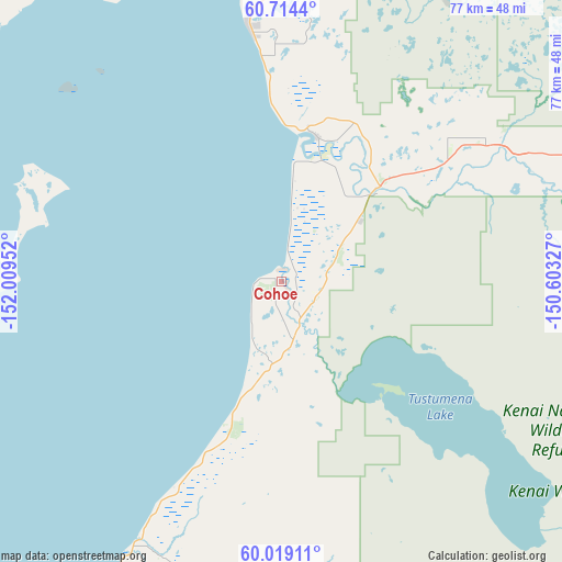
Cohoe GPS coordinates[2]
60° 22' 6.996" North, 151° 18' 23.004" West
| Map corner | latitude | longitude |
|---|---|---|
| Upper-left | 60.7144°, | -152.00952° |
| Center: | 60.36861°, | -151.30639° |
| Lower-right: | 60.01911°, | -150.60327° |
| Map W x H: | 77.3×77.3 km | = 48×48mi |
| max Lat: | 71.29058° ⇑0.4% North |
| Cohoe: | 60.36861° |
| min Lat: | ⇓99.6% South 19.06759° |
| min Long | Cohoe | max Long |
| -171.73463° | -151.30639° | -66.98998° |
| W 0.9%⇐ | ⇒99.1% E |
Elevation
Elevation of Cohoe is 7 m = 23 ft, and this is 287.8 m = 944 ft below average elevation for this country.
| Max E: |
3189 m = 10463 ft | 96.6% |
| Avg. | 294.8 m = 967 ft | |
| Cohoe | 7 m = 23 ft | |
Min E: |
-60 m = -197 ft | 3.4% |
See also: United States elevation on elevation.city.
Geographical zone
Cohoe is located in North temperate zone (between Tropic of Cancer and the Arctic Circle). Distance of this North polar circle is 688.8 km =428 mi to North.| Distance of | km | miles | from Cohoe |
|---|---|---|---|
| North Pole | 3294.7 | 2047.2 | to North |
| Arctic Circle | 688.8 | 428 | to North |
| Tropic Cancer | 4106.4 | 2551.6 | to South |
| Equator | 6712.4 | 4170.9 | to South |


Nearby cities:
15 places around Cohoe: (largest is in red/bold)
• Anchor Point
72 km =44.7 mi,  203°
203°
• Diamond Ridge
78.3 km =48.7 mi,  190°
190°
• Fox River
59.9 km =37.2 mi,  161°
161°
• Fritz Creek
70.3 km =43.7 mi,  179°
179°
• Funny River
33.3 km =20.7 mi,  63°
63°
• Happy Valley
52.4 km =32.6 mi,  206°
206°
• Kalifornsky
5.6 km =3.5 mi,  9°
9°
• Kasilof
3.9 km =2.4 mi,  153°
153°
• Kenai
20.8 km =12.9 mi, 7°
• Nikiski
35.8 km =22.2 mi,  1°
1°
• Ninilchik
40.6 km =25.2 mi, 209°
• Ridgeway
21.8 km =13.5 mi,  33°
33°
• Salamatof
27.4 km =17 mi,  358°
358°
• Soldotna
19 km =11.8 mi,  45°
45°
• Sterling
35.1 km =21.8 mi, 57°
Sources, notices
• [Note1] Compared only with cities in United States existing in our database
• [Src1] Map data: © OpenStreetMap contributors (CC-BY-SA)
• [Src2] Other city data from geonames.org with taken over terms of usage.
• [Src3] Geographical zone / Annual Mean Temperature by Robert A. Rohde @ Wikipedia
