Unalakleet geodata
Unalakleet (Alaska) is a populated place; located in United States in America/Anchorage (GMT-8) time zone. With population of 708 people, there are 18595 cities with bigger population in this country. Compared to other cities in United States, 99.9% of cities are located further ↓South; 99.9% of cities are located further →East and 99.6% of cities have higher elevation than Unalakleet. Note1


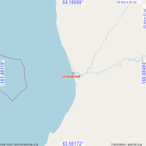
Unalakleet GPS coordinates[2]
63° 52' 23.016" North, 160° 47' 17.016" West
| Map corner | latitude | longitude |
|---|---|---|
| Upper-left | 64.18099°, | -161.49119° |
| Center: | 63.87306°, | -160.78806° |
| Lower-right: | 63.56172°, | -160.08494° |
| Map W x H: | 68.9×68.9 km | = 42.8×42.8mi |
| max Lat: | 71.29058° ⇑0.1% North |
| Unalakleet: | 63.87306° |
| min Lat: | ⇓99.9% South 19.06759° |
| min Long | Unalakleet | max Long |
| -171.73463° | -160.78806° | -66.98998° |
| W 0.1%⇐ | ⇒99.9% E |
Elevation
Elevation of Unalakleet is 1 m = 3 ft, and this is 293.8 m = 964 ft below average elevation for this country.
| Max E: |
3189 m = 10463 ft | 99.6% |
| Avg. | 294.8 m = 967 ft | |
| Unalakleet | 1 m = 3 ft | |
Min E: |
-60 m = -197 ft | 0.4% |
See also: United States elevation on elevation.city.
Geographical zone
Unalakleet is located in North temperate zone (between Tropic of Cancer and the Arctic Circle). Distance of this North polar circle is 299.2 km =185.9 mi to North.| Distance of | km | miles | from Unalakleet |
|---|---|---|---|
| North Pole | 2905 | 1805.1 | to North |
| Arctic Circle | 299.2 | 185.9 | to North |
| Tropic Cancer | 4496.1 | 2793.7 | to South |
| Equator | 7102 | 4413 | to South |


Nearby cities:
15 places around Unalakleet: (largest is in red/bold)
• Akiachak
331.2 km =205.8 mi,  185°
185°
• Aniak
263.2 km =163.5 mi,  165°
165°
• Bethel
346.2 km =215.1 mi, 188°
• Emmonak
222.6 km =138.3 mi,  236°
236°
• Kasigluk
342.8 km =213 mi,  195°
195°
• Kotlik
166.1 km =103.2 mi, 235°
• Kotzebue
346.6 km =215.4 mi,  346°
346°
• Kwethluk
342.1 km =212.6 mi, 185°
• Mountain Village
248.1 km =154.2 mi,  216°
216°
• Noorvik
329.9 km =205 mi,  358°
358°
• Nunapitchuk
341.9 km =212.4 mi, 194°
• Pilot Station
239.6 km =148.9 mi,  206°
206°
• Selawik
305.8 km =190 mi,  6°
6°
• St. Mary's
235.6 km =146.4 mi, 210°
• Stebbins
83.7 km =52 mi, 242°
Sources, notices
• [Note1] Compared only with cities in United States existing in our database
• [Src1] Map data: © OpenStreetMap contributors (CC-BY-SA)
• [Src2] Other city data from geonames.org with taken over terms of usage.
• [Src3] Geographical zone / Annual Mean Temperature by Robert A. Rohde @ Wikipedia
