Wakefield-Peacedale geodata
Wakefield-Peacedale (Rhode Island) is a populated place; located in United States in America/New_York (GMT-4) time zone. With population of 8,487 people, there are 5023 cities with bigger population in this country. Compared to other cities in United States, 70.2% of cities are located further ↓South; 96.6% of cities are located further ←West and 90.5% of cities have higher elevation than Wakefield-Peacedale. Note1
Administrative division(s):
- Level 1: Rhode Island
- Level 2: Washington County
- Level 3: Town of South Kingstown


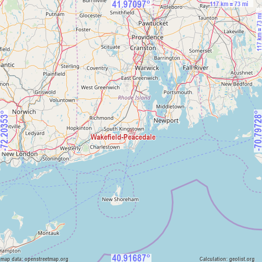
Wakefield-Peacedale GPS coordinates[2]
41° 26' 45.816" North, 71° 30' 1.44" West
| Map corner | latitude | longitude |
|---|---|---|
| Upper-left | 41.97097°, | -72.20353° |
| Center: | 41.44606°, | -71.5004° |
| Lower-right: | 40.91687°, | -70.79728° |
| Map W x H: | 117.2×117.2 km | = 72.8×72.8mi |
| max Lat: | 71.29058° ⇑29.8% North |
| Wakefield-Peacedale: | 41.44606° |
| min Lat: | ⇓70.2% South 19.06759° |
| min Long | Wakefield-Peace | max Long |
| -171.73463° | -71.5004° | -66.98998° |
| W 96.6%⇐ | ⇒3.4% E |
Elevation
Elevation of Wakefield-Peacedale is 15 m = 49 ft, and this is 279.8 m = 918 ft below average elevation for this country.
| Max E: |
3189 m = 10463 ft | 90.5% |
| Avg. | 294.8 m = 967 ft | |
| Wakefield-Peacedale | 15 m = 49 ft | |
Min E: |
-60 m = -197 ft | 9.5% |
See also: United States elevation on elevation.city.
Geographical zone
Wakefield-Peacedale is located in North temperate zone (between Tropic of Cancer and the Arctic Circle). Distance of this Northern Tropic circle is 2002.5 km =1244.3 mi to South.| Distance of | km | miles | from Wakefield-Peacedale |
|---|---|---|---|
| North Pole | 5398.7 | 3354.6 | to North |
| Arctic Circle | 2792.8 | 1735.4 | to North |
| Tropic Cancer | 2002.5 | 1244.3 | to South |
| Equator | 4608.4 | 2863.5 | to South |


Nearby cities:
15 places around Wakefield-Peacedale: (largest is in red/bold)
• Bradford
20.4 km =12.7 mi,  255°
255°
• Carolina
13.6 km =8.5 mi,  275°
275°
• Charlestown
13.7 km =8.5 mi,  239°
239°
• Exeter
14.9 km =9.3 mi,  348°
348°
• Hope Valley
19.2 km =11.9 mi,  290°
290°
• Hopkinton
23.2 km =14.4 mi,  274°
274°
• Jamestown
12.5 km =7.8 mi,  62°
62°
• Kingston
4.2 km =2.6 mi,  334°
334°
• Middletown
20.6 km =12.8 mi, 57°
• Narragansett
4.3 km =2.7 mi,  83°
83°
• Narragansett Pier
4 km =2.5 mi,  112°
112°
• Newport
16.4 km =10.2 mi,  72°
72°
• Newport East
19.4 km =12.1 mi, 66°
• North Kingstown
11.9 km =7.4 mi,  13°
13°
• South Kingstown
2 km =1.2 mi, 273°
Sources, notices
• [Note1] Compared only with cities in United States existing in our database
• [Src1] Map data: © OpenStreetMap contributors (CC-BY-SA)
• [Src2] Other city data from geonames.org with taken over terms of usage.
• [Src3] Geographical zone / Annual Mean Temperature by Robert A. Rohde @ Wikipedia
