Hope Valley geodata
Hope Valley (Rhode Island) is a populated place; located in United States in America/New_York (GMT-4) time zone. With population of 1,612 people, there are 13255 cities with bigger population in this country. Compared to other cities in United States, 70.9% of cities are located further ↓South; 96.2% of cities are located further ←West and 84.8% of cities have higher elevation than Hope Valley. Note1
Administrative division(s):
- Level 1: Rhode Island
- Level 2: Washington County
- Level 3: Town of Hopkinton


Hope Valley GPS coordinates[2]
41° 30' 27.36" North, 71° 42' 58.248" West
| Map corner | latitude | longitude |
|---|---|---|
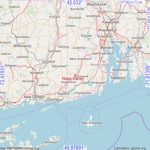
| Upper-left | 42.032°, | -72.41931° |
| Center: | 41.5076°, | -71.71618° |
| Lower-right: | 40.97891°, | -71.01306° |
| Map W x H: | 117.1×117.1 km | = 72.8×72.8mi |
| max Lat: | 71.29058° ⇑29.1% North |
| Hope Valley: | 41.5076° |
| min Lat: | ⇓70.9% South 19.06759° |
| min Long | Hope Valley | max Long |
| -171.73463° | -71.71618° | -66.98998° |
| W 96.2%⇐ | ⇒3.8% E |
Elevation
Elevation of Hope Valley is 29 m = 95 ft, and this is 265.8 m = 872 ft below average elevation for this country.
| Max E: |
3189 m = 10463 ft | 84.8% |
| Avg. | 294.8 m = 967 ft | |
| Hope Valley | 29 m = 95 ft | |
Min E: |
-60 m = -197 ft | 15.2% |
See also: United States elevation on elevation.city.
Geographical zone
Hope Valley is located in North temperate zone (between Tropic of Cancer and the Arctic Circle). Distance of this Northern Tropic circle is 2009.3 km =1248.5 mi to South.| Distance of | km | miles | from Hope Valley |
|---|---|---|---|
| North Pole | 5391.8 | 3350.3 | to North |
| Arctic Circle | 2786 | 1731.1 | to North |
| Tropic Cancer | 2009.3 | 1248.5 | to South |
| Equator | 4615.2 | 2867.8 | to South |


Nearby cities:
15 places around Hope Valley: (largest is in red/bold)
• Ashaway
11 km =6.8 mi,  211°
211°
• Bradford
12.2 km =7.6 mi,  188°
188°
• Carolina
7.1 km =4.4 mi,  141°
141°
• Charlestown
15.2 km =9.4 mi,  155°
155°
• Coventry
21.6 km =13.4 mi,  7°
7°
• Exeter
16.8 km =10.4 mi,  62°
62°
• Greene
20.6 km =12.8 mi,  353°
353°
• Hopkinton
7.3 km =4.5 mi,  224°
224°
• Kingston
16.4 km =10.2 mi,  100°
100°
• North Kingstown
21.3 km =13.2 mi,  77°
77°
• Pawcatuck
17.5 km =10.9 mi, 214°
• South Kingstown
17.3 km =10.7 mi,  112°
112°
• Wakefield-Peacedale
19.2 km =11.9 mi, 110°
• West Greenwich
15.1 km =9.4 mi,  17°
17°
• Westerly
17.2 km =10.7 mi, 212°
Sources, notices
• [Note1] Compared only with cities in United States existing in our database
• [Src1] Map data: © OpenStreetMap contributors (CC-BY-SA)
• [Src2] Other city data from geonames.org with taken over terms of usage.
• [Src3] Geographical zone / Annual Mean Temperature by Robert A. Rohde @ Wikipedia
