Moorestown-Lenola geodata
Moorestown-Lenola (New Jersey) is a populated place; located in United States in America/New_York (GMT-4) time zone. With population of 14,217 people, there are 3389 cities with bigger population in this country. Compared to other cities in United States, 53.2% of cities are located further ↓South; 87.5% of cities are located further ←West and 86.2% of cities have higher elevation than Moorestown-Lenola. Note1
Administrative division(s):
- Level 1: New Jersey
- Level 2: Burlington County
- Level 3: Township of Moorestown


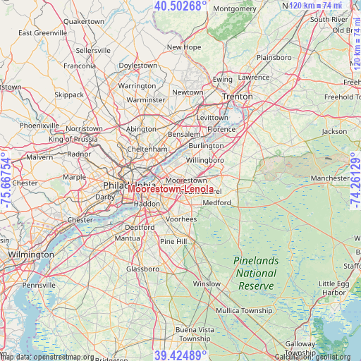
Moorestown-Lenola GPS coordinates[2]
39° 57' 57.276" North, 74° 57' 51.876" West
| Map corner | latitude | longitude |
|---|---|---|
| Upper-left | 40.50268°, | -75.66754° |
| Center: | 39.96591°, | -74.96441° |
| Lower-right: | 39.42489°, | -74.26129° |
| Map W x H: | 119.8×119.8 km | = 74.4×74.4mi |
| max Lat: | 71.29058° ⇑46.8% North |
| Moorestown-Lenola: | 39.96591° |
| min Lat: | ⇓53.2% South 19.06759° |
| min Long | Moorestown-Leno | max Long |
| -171.73463° | -74.96441° | -66.98998° |
| W 87.5%⇐ | ⇒12.5% E |
Elevation
Elevation of Moorestown-Lenola is 25 m = 82 ft, and this is 269.8 m = 885 ft below average elevation for this country.
| Max E: |
3189 m = 10463 ft | 86.2% |
| Avg. | 294.8 m = 967 ft | |
| Moorestown-Lenola | 25 m = 82 ft | |
Min E: |
-60 m = -197 ft | 13.8% |
See also: United States elevation on elevation.city.
Geographical zone
Moorestown-Lenola is located in North temperate zone (between Tropic of Cancer and the Arctic Circle). Distance of this Northern Tropic circle is 1837.9 km =1142 mi to South.| Distance of | km | miles | from Moorestown-Lenola |
|---|---|---|---|
| North Pole | 5563.3 | 3456.9 | to North |
| Arctic Circle | 2957.4 | 1837.6 | to North |
| Tropic Cancer | 1837.9 | 1142 | to South |
| Equator | 4443.8 | 2761.2 | to South |


Nearby cities:
15 places around Moorestown-Lenola: (largest is in red/bold)
• Cherry Hill
6.6 km =4.1 mi,  238°
238°
• Cherry Hill Mall
5.1 km =3.2 mi,  228°
228°
• Cinnaminson
4.2 km =2.6 mi,  324°
324°
• Ellisburg
7 km =4.3 mi,  214°
214°
• Golden Triangle
7.6 km =4.7 mi, 236°
• Greentree
7.7 km =4.8 mi,  174°
174°
• Kingston Estates
5.1 km =3.2 mi,  203°
203°
• Maple Shade
2.8 km =1.7 mi, 238°
• Mount Laurel
7.2 km =4.5 mi,  119°
119°
• Palmyra
7.1 km =4.4 mi,  310°
310°
• Pennsauken
8 km =5 mi,  262°
262°
• Ramblewood
4.5 km =2.8 mi,  156°
156°
• Riverton
5.5 km =3.4 mi,  329°
329°
• Riverton
6.6 km =4.1 mi, 319°
• Springdale
7 km =4.3 mi,  181°
181°
Sources, notices
• [Note1] Compared only with cities in United States existing in our database
• [Src1] Map data: © OpenStreetMap contributors (CC-BY-SA)
• [Src2] Other city data from geonames.org with taken over terms of usage.
• [Src3] Geographical zone / Annual Mean Temperature by Robert A. Rohde @ Wikipedia
