Springdale geodata
Springdale (New Jersey) is a populated place; located in United States in America/New_York (GMT-4) time zone. With population of 14,518 people, there are 3333 cities with bigger population in this country. Compared to other cities in United States, 52.5% of cities are located further ↓South; 87.4% of cities are located further ←West and 84.8% of cities have higher elevation than Springdale. Note1
Administrative division(s):
- Level 1: New Jersey
- Level 2: Camden County
- Level 3: Township of Cherry Hill


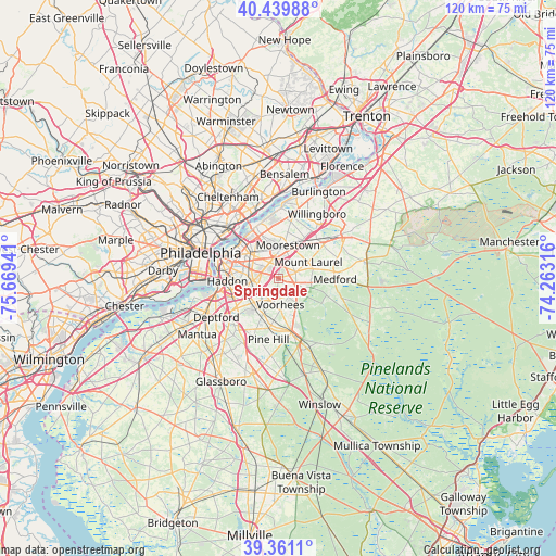
Springdale GPS coordinates[2]
39° 54' 9.396" North, 74° 57' 58.608" West
| Map corner | latitude | longitude |
|---|---|---|
| Upper-left | 40.43988°, | -75.66941° |
| Center: | 39.90261°, | -74.96628° |
| Lower-right: | 39.3611°, | -74.26316° |
| Map W x H: | 119.9×119.9 km | = 74.5×74.5mi |
| max Lat: | 71.29058° ⇑47.5% North |
| Springdale: | 39.90261° |
| min Lat: | ⇓52.5% South 19.06759° |
| min Long | Springdale | max Long |
| -171.73463° | -74.96628° | -66.98998° |
| W 87.4%⇐ | ⇒12.6% E |
Elevation
Elevation of Springdale is 29 m = 95 ft, and this is 265.8 m = 872 ft below average elevation for this country.
| Max E: |
3189 m = 10463 ft | 84.8% |
| Avg. | 294.8 m = 967 ft | |
| Springdale | 29 m = 95 ft | |
Min E: |
-60 m = -197 ft | 15.2% |
See also: United States elevation on elevation.city.
Geographical zone
Springdale is located in North temperate zone (between Tropic of Cancer and the Arctic Circle). Distance of this Northern Tropic circle is 1830.8 km =1137.6 mi to South.| Distance of | km | miles | from Springdale |
|---|---|---|---|
| North Pole | 5570.3 | 3461.2 | to North |
| Arctic Circle | 2964.4 | 1842 | to North |
| Tropic Cancer | 1830.8 | 1137.6 | to South |
| Equator | 4436.8 | 2756.9 | to South |


Nearby cities:
15 places around Springdale: (largest is in red/bold)
• Ashland
5.5 km =3.4 mi,  217°
217°
• Brookfield
4.8 km =3 mi,  242°
242°
• Cherry Hill
6.6 km =4.1 mi,  303°
303°
• Cherry Hill Mall
5.2 km =3.2 mi,  315°
315°
• Echelon
6.5 km =4 mi,  202°
202°
• Ellisburg
4 km =2.5 mi,  288°
288°
• Golden Triangle
6.8 km =4.2 mi, 294°
• Greentree
1.1 km =0.7 mi,  124°
124°
• Haddonfield
6.2 km =3.9 mi,  258°
258°
• Kingston Estates
3 km =1.9 mi, 321°
• Lawnside
6.6 km =4.1 mi,  232°
232°
• Maple Shade
6 km =3.7 mi,  338°
338°
• Marlton
4 km =2.5 mi,  108°
108°
• Moorestown-Lenola
7 km =4.3 mi,  1°
1°
• Ramblewood
3.5 km =2.2 mi,  33°
33°
Sources, notices
• [Note1] Compared only with cities in United States existing in our database
• [Src1] Map data: © OpenStreetMap contributors (CC-BY-SA)
• [Src2] Other city data from geonames.org with taken over terms of usage.
• [Src3] Geographical zone / Annual Mean Temperature by Robert A. Rohde @ Wikipedia
