Lynnwood-Pricedale geodata
Lynnwood-Pricedale (Pennsylvania) is a populated place; located in United States in America/New_York (GMT-4) time zone. With population of 2,031 people, there are 11857 cities with bigger population in this country. Compared to other cities in United States, 54.9% of cities are located further ↓South; 74% of cities are located further ←West and 69.5% of cities have lower elevation than Lynnwood-Pricedale. Note1
Administrative division(s):
- Level 1: Pennsylvania
- Level 2: Westmoreland County
- Level 3: Township of Rostraver


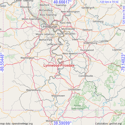
Lynnwood-Pricedale GPS coordinates[2]
40° 7' 50.556" North, 79° 51' 4.86" West
| Map corner | latitude | longitude |
|---|---|---|
| Upper-left | 40.66617°, | -80.55448° |
| Center: | 40.13071°, | -79.85135° |
| Lower-right: | 39.59099°, | -79.14823° |
| Map W x H: | 119.5×119.5 km | = 74.3×74.3mi |
| max Lat: | 71.29058° ⇑45.1% North |
| Lynnwood-Pricedale: | 40.13071° |
| min Lat: | ⇓54.9% South 19.06759° |
| min Long | Lynnwood-Priced | max Long |
| -171.73463° | -79.85135° | -66.98998° |
| W 74%⇐ | ⇒26% E |
Elevation
Elevation of Lynnwood-Pricedale is 283 m = 928 ft, and this is 11.8 m = 39 ft below average elevation for this country.
| Max E: |
3189 m = 10463 ft | 30.5% |
| Avg. | 294.8 m = 967 ft | |
| Lynnwood-Pricedale | 283 m = 928 ft | |
Min E: |
-60 m = -197 ft | 69.5% |
See also: United States elevation on elevation.city.
Geographical zone
Lynnwood-Pricedale is located in North temperate zone (between Tropic of Cancer and the Arctic Circle). Distance of this Northern Tropic circle is 1856.2 km =1153.4 mi to South.| Distance of | km | miles | from Lynnwood-Pricedale |
|---|---|---|---|
| North Pole | 5544.9 | 3445.4 | to North |
| Arctic Circle | 2939.1 | 1826.3 | to North |
| Tropic Cancer | 1856.2 | 1153.4 | to South |
| Equator | 4462.1 | 2772.6 | to South |


Nearby cities:
15 places around Lynnwood-Pricedale: (largest is in red/bold)
• Allenport
3.6 km =2.2 mi,  176°
176°
• Belle Vernon
1.4 km =0.9 mi,  243°
243°
• Charleroi
4.1 km =2.5 mi,  281°
281°
• Donora
4.8 km =3 mi,  353°
353°
• Fairhope
2.1 km =1.3 mi,  152°
152°
• Fayette City
3.5 km =2.2 mi,  164°
164°
• Fellsburg
6.3 km =3.9 mi,  21°
21°
• Monessen
3.7 km =2.3 mi,  302°
302°
• Newell
7.3 km =4.5 mi,  212°
212°
• North Belle Vernon
1.4 km =0.9 mi,  263°
263°
• North Charleroi
5.3 km =3.3 mi, 295°
• Roscoe
5.8 km =3.6 mi,  192°
192°
• Speers
2.5 km =1.6 mi,  254°
254°
• Stockdale
5.3 km =3.3 mi, 176°
• Wickerham Manor-Fisher
7 km =4.3 mi,  317°
317°
Sources, notices
• [Note1] Compared only with cities in United States existing in our database
• [Src1] Map data: © OpenStreetMap contributors (CC-BY-SA)
• [Src2] Other city data from geonames.org with taken over terms of usage.
• [Src3] Geographical zone / Annual Mean Temperature by Robert A. Rohde @ Wikipedia
