Tamalpais-Homestead Valley geodata
Tamalpais-Homestead Valley (California) is a populated place; located in United States in America/Los_Angeles (GMT-7) time zone. With population of 10,735 people, there are 4255 cities with bigger population in this country. Compared to other cities in United States, 62.3% of cities are located further ↑North; 96.7% of cities are located further →East and 92.1% of cities have higher elevation than Tamalpais-Homestead Valley. Note1
Current local time in Tamalpais-Homestead Valley:
02:47 PM, SundayDifference from your time zone: hours


Tamalpais-Homestead Valley GPS coordinates[2]
37° 52' 42.024" North, 122° 32' 10.5" West
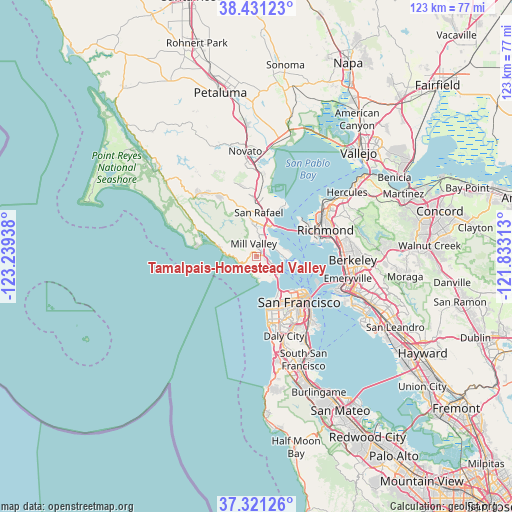
| Map corner | latitude | longitude |
|---|---|---|
| Upper-left | 38.43123°, | -123.23938° |
| Center: | 37.87834°, | -122.53625° |
| Lower-right: | 37.32126°, | -121.83313° |
| Map W x H: | 123.4×123.4 km | = 76.7×76.7mi |
| max Lat: | 71.29058° ⇑62.3% North |
| Tamalpais-Homestead Valley: | 37.87834° |
| min Lat: | ⇓37.7% South 19.06759° |
| min Long | Tamalpais-Homes | max Long |
| -171.73463° | -122.53625° | -66.98998° |
| W 3.3%⇐ | ⇒96.7% E |
Elevation
Elevation of Tamalpais-Homestead Valley is 12 m = 39 ft, and this is 282.8 m = 928 ft below average elevation for this country.
| Max E: |
3189 m = 10463 ft | 92.1% |
| Avg. | 294.8 m = 967 ft | |
| Tamalpais-Homestead Valley | 12 m = 39 ft | |
Min E: |
-60 m = -197 ft | 7.9% |
See also: United States elevation on elevation.city.
Geographical zone
Tamalpais-Homestead Valley is located in North temperate zone (between Tropic of Cancer and the Arctic Circle). Distance of this Northern Tropic circle is 1605.8 km =997.8 mi to South.| Distance of | km | miles | from Tamalpais-Homestead Valley |
|---|---|---|---|
| North Pole | 5795.4 | 3601.1 | to North |
| Arctic Circle | 3189.5 | 1981.9 | to North |
| Tropic Cancer | 1605.8 | 997.8 | to South |
| Equator | 4211.7 | 2617 | to South |


Nearby cities:
15 places around Tamalpais-Homestead Valley: (largest is in red/bold)
• Alto
3 km =1.9 mi,  18°
18°
• Belvedere
6.3 km =3.9 mi,  95°
95°
• Corte Madera
5.3 km =3.3 mi,  8°
8°
• Kentfield
8.4 km =5.2 mi,  347°
347°
• Larkspur
6.2 km =3.9 mi,  0°
0°
• Marin City
2.6 km =1.6 mi,  114°
114°
• Mill Valley
3.2 km =2 mi, 346°
• Ross
9.5 km =5.9 mi, 350°
• San Anselmo
10.9 km =6.8 mi, 348°
• San Rafael
10.6 km =6.6 mi, 2°
• Sausalito
5 km =3.1 mi,  115°
115°
• Stinson Beach
9.8 km =6.1 mi,  284°
284°
• Strawberry
3.2 km =2 mi,  49°
49°
• Tamalpais Valley
0.9 km =0.6 mi, 279°
• Tiburon
7 km =4.3 mi,  94°
94°
Sources, notices
• [Note1] Compared only with cities in United States existing in our database
• [Src1] Map data: © OpenStreetMap contributors (CC-BY-SA)
• [Src2] Other city data from geonames.org with taken over terms of usage.
• [Src3] Geographical zone / Annual Mean Temperature by Robert A. Rohde @ Wikipedia
