Woodstock geodata
Woodstock (Maine) is a populated locality; located in United States in America/New_York (GMT-4) time zone. With population of 1,263 people, there are 14772 cities with bigger population in this country. Compared to other cities in United States, 90% of cities are located further ↓South; 98.3% of cities are located further ←West and 65.4% of cities have lower elevation than Woodstock. Note1


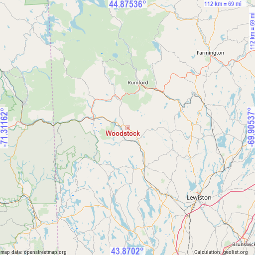
Woodstock GPS coordinates[2]
44° 22' 29.784" North, 70° 36' 30.564" West
| Map corner | latitude | longitude |
|---|---|---|
| Upper-left | 44.87536°, | -71.31162° |
| Center: | 44.37494°, | -70.60849° |
| Lower-right: | 43.8702°, | -69.90537° |
| Map W x H: | 111.8×111.8 km | = 69.5×69.5mi |
| max Lat: | 71.29058° ⇑10% North |
| Woodstock: | 44.37494° |
| min Lat: | ⇓90% South 19.06759° |
| min Long | Woodstock | max Long |
| -171.73463° | -70.60849° | -66.98998° |
| W 98.3%⇐ | ⇒1.7% E |
Elevation
Elevation of Woodstock is 264 m = 866 ft, and this is 30.8 m = 101 ft below average elevation for this country.
| Max E: |
3189 m = 10463 ft | 34.6% |
| Avg. | 294.8 m = 967 ft | |
| Woodstock | 264 m = 866 ft | |
Min E: |
-60 m = -197 ft | 65.4% |
See also: United States elevation on elevation.city.
Geographical zone
Woodstock is located in North temperate zone (between Tropic of Cancer and the Arctic Circle). Distance of this Northern Tropic circle is 2328.1 km =1446.6 mi to South.| Distance of | km | miles | from Woodstock |
|---|---|---|---|
| North Pole | 5073 | 3152.2 | to North |
| Arctic Circle | 2467.1 | 1533 | to North |
| Tropic Cancer | 2328.1 | 1446.6 | to South |
| Equator | 4934 | 3065.8 | to South |


Nearby cities:
15 places around Woodstock: (largest is in red/bold)
• Bethel
14.8 km =9.2 mi,  282°
282°
• Buckfield
21.5 km =13.4 mi,  116°
116°
• Canton
24.3 km =15.1 mi,  72°
72°
• Dixfield
21.4 km =13.3 mi,  34°
34°
• Greenwood
7.1 km =4.4 mi,  208°
208°
• Hartford
20.8 km =12.9 mi,  90°
90°
• Hebron
25.4 km =15.8 mi,  140°
140°
• Mexico
21.3 km =13.2 mi,  13°
13°
• Norway
18.6 km =11.6 mi,  164°
164°
• Paris
15.4 km =9.6 mi,  146°
146°
• Peru
21.8 km =13.5 mi,  47°
47°
• Rumford
20.4 km =12.7 mi, 12°
• South Paris
18.4 km =11.4 mi, 155°
• Sumner
13.6 km =8.5 mi,  82°
82°
• West Paris
6.3 km =3.9 mi, 154°
Sources, notices
• [Note1] Compared only with cities in United States existing in our database
• [Src1] Map data: © OpenStreetMap contributors (CC-BY-SA)
• [Src2] Other city data from geonames.org with taken over terms of usage.
• [Src3] Geographical zone / Annual Mean Temperature by Robert A. Rohde @ Wikipedia
