Da Nang geodata
Da Nang is a seat of a first-order administrative division; located in Vietnam in Asia/Ho_Chi_Minh (GMT+7) time zone. With population of 752,493 people, there are 2 cities with bigger population in this country. Compared to other cities in Vietnam, 52.2% of cities are located further ↑North; 87.8% of cities are located further ←West and 58.1% of cities have higher elevation than Da Nang. Note1


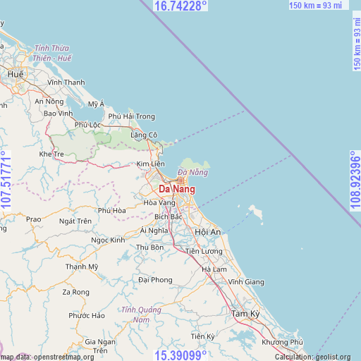
Da Nang GPS coordinates[2]
16° 4' 4.008" North, 108° 13' 14.988" East
| Map corner | latitude | longitude |
|---|---|---|
| Upper-left | 16.74228°, | 107.51771° |
| Center: | 16.06778°, | 108.22083° |
| Lower-right: | 15.39099°, | 108.92396° |
| Map W x H: | 150.2×150.3 km | = 93.3×93.4mi |
| max Lat: | 23.27841° ⇑52.2% North |
| Da Nang: | 16.06778° |
| min Lat: | ⇓47.8% South 8.65724° |
| min Long | Da Nang | max Long |
| 102.4579° | 108.22083° | 112.72541° |
| W 87.8%⇐ | ⇒12.2% E |
Elevation
Elevation of Da Nang is 11 m = 36 ft, and this is 118.5 m = 389 ft below average elevation for this country.
| Max E: |
1592 m = 5223 ft | 58.1% |
| Avg. | 129.5 m = 425 ft | |
| Da Nang | 11 m = 36 ft | |
Min E: |
-1 m = -3 ft | 41.9% |
See also: Da Nang elevation on elevation.city.
Geographical zone
Da Nang is located in North Torrid zone (between Equator and Tropic of Cancer). Distance of this Northern Tropic circle is 819.3 km =509.1 mi to North.| Distance of | km | miles | from Da Nang |
|---|---|---|---|
| North Pole | 8220.5 | 5108 | to North |
| Arctic Circle | 5614.6 | 3488.7 | to North |
| Tropic Cancer | 819.3 | 509.1 | to North |
| Equator | 1786.6 | 1110.1 | to South |


Nearby cities:
15 places around Da Nang: (largest is in red/bold)
• Cẩm Lệ
5.9 km =3.7 mi,  198°
198°
• Duy Xuyên
26.9 km =16.7 mi,  171°
171°
• Hà Lam
39.1 km =24.3 mi,  159°
159°
• Hòa Vang
12.5 km =7.8 mi,  224°
224°
• Hội An
24.2 km =15 mi,  149°
149°
• Khe Tre
54.9 km =34.1 mi,  281°
281°
• Liên Chiểu
6.7 km =4.2 mi,  274°
274°
• Ngũ Hành Sơn
6.7 km =4.2 mi, 148°
• Phú Lộc
45.3 km =28.1 mi,  301°
301°
• Quang Nam
20.3 km =12.6 mi, 169°
• Quế Sơn
43.8 km =27.2 mi,  180°
180°
• Sơn Trà
1.5 km =0.9 mi,  122°
122°
• Thanh Khê
3.2 km =2 mi, 275°
• Thạnh Mỹ
54.3 km =33.7 mi,  229°
229°
• Đại Lộc
23.2 km =14.4 mi,  207°
207°
Sources, notices
• [Note1] Compared only with cities in Vietnam existing in our database
• [Src1] Map data: © OpenStreetMap contributors (CC-BY-SA)
• [Src2] Other city data from geonames.org with taken over terms of usage.
• [Src3] Geographical zone / Annual Mean Temperature by Robert A. Rohde @ Wikipedia
