Port-Olry geodata
Port-Olry (Sanma) is a populated place; located in Vanuatu in Pacific/Efate (GMT+11) time zone. With population of 1,951 people, there are 3 cities with bigger population in this country. Compared to other cities in Vanuatu, 85.7% of cities are located further ↓South; 100% of cities are located further →East and 71.4% of cities have higher elevation than Port-Olry. Note1


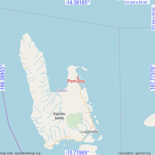
Port-Olry GPS coordinates[2]
15° 2' 30.3" South, 167° 4' 21.54" East
| Map corner | latitude | longitude |
|---|---|---|
| Upper-left | -14.36165°, | 166.36953° |
| Center: | -15.04175°, | 167.07265° |
| Lower-right: | -15.71969°, | 167.77578° |
| Map W x H: | 151×151 km | = 93.8×93.8mi |
| max Lat: | -13.87611° ⇑14.3% North |
| Port-Olry: | -15.04175° |
| min Lat: | ⇓85.7% South -19.54167° |
| min Long | Port-Olry | max Long |
| 167.07265° | 167.07265° | 169.28167° |
| W 0%⇐ | ⇒100% E |
Elevation
Elevation of Port-Olry is 9 m = 30 ft, and this is 30.4 m = 100 ft below average elevation for this country.
| Max E: |
150 m = 492 ft | 71.4% |
| Avg. | 39.4 m = 129 ft | |
| Port-Olry | 9 m = 30 ft | |
Min E: |
1 m = 3 ft | 28.6% |
See also: Vanuatu elevation on elevation.city.
Geographical zone
Port-Olry is located in South Torrid zone (between Equator and Tropic of Capricorn). Distance of this Southern Tropic circle is 933.4 km =580 mi to South.| Distance of | km | miles | from Port-Olry |
|---|---|---|---|
| Equator | 1672.5 | 1039.2 | to North |
| Tropic Capricorn | 933.4 | 580 | to South |
| Antarctic Circle | 5728.7 | 3559.6 | to South |
| South Pole | 8334.6 | 5178.9 | to South |


Nearby cities:
6 places around Port-Olry: (largest is in red/bold)
• Lakatoro
123.3 km =76.6 mi,  162°
162°
• Luganville
54 km =33.6 mi,  169°
169°
• Norsup
119 km =73.9 mi, 163°
• Port-Vila
327.6 km =203.6 mi, 156°
• Saratamata
99.9 km =62.1 mi,  106°
106°
• Sola
139.5 km =86.7 mi,  21°
21°
Sources, notices
• [Note1] Compared only with cities in Vanuatu existing in our database
• [Src1] Map data: © OpenStreetMap contributors (CC-BY-SA)
• [Src2] Other city data from geonames.org with taken over terms of usage.
• [Src3] Geographical zone / Annual Mean Temperature by Robert A. Rohde @ Wikipedia
