Falaleu geodata
Falaleu (Uvea) is a populated place; located in Wallis and Futuna in Pacific/Wallis (GMT+12) time zone. With population of 626 people, there are 3 cities with bigger population in this country. Compared to other cities in Wallis and Futuna, 55.6% of cities are located further ↑North; 66.7% of cities are located further ←West and 100% of cities have higher elevation than Falaleu. Note1


Falaleu GPS coordinates[2]
13° 17' 33.576" South, 176° 10' 59.808" West
| Map corner | latitude | longitude |
|---|---|---|
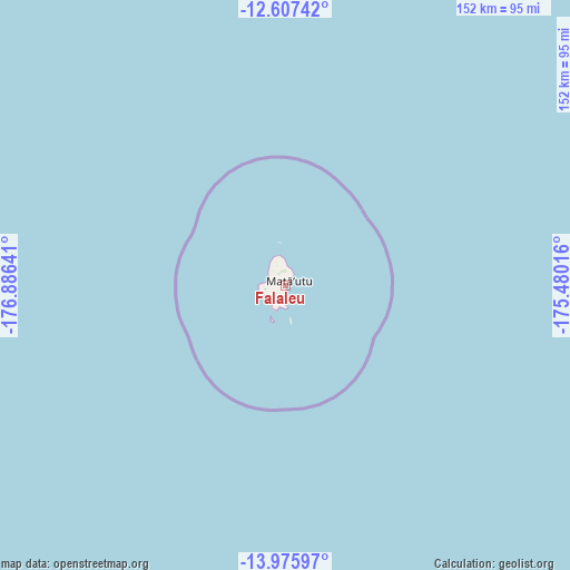
| Upper-left | -12.60742°, | -176.88641° |
| Center: | -13.29266°, | -176.18328° |
| Lower-right: | -13.97597°, | -175.48016° |
| Map W x H: | 152.2×152.2 km | = 94.6×94.6mi |
| max Lat: | -13.227° ⇑55.6% North |
| Falaleu: | -13.29266° |
| min Lat: | ⇓44.4% South -14.31096° |
| min Long | Falaleu | max Long |
| -178.15833° | -176.18328° | -176.16586° |
| W 66.7%⇐ | ⇒33.3% E |
Elevation
Elevation of Falaleu is 7 m = 23 ft, and this is 7 m = 23 ft below average elevation for this country.
| Max E: |
27 m = 89 ft | 100% |
| Avg. | 14 m = 46 ft | |
| Falaleu | 7 m = 23 ft | |
Min E: |
7 m = 23 ft | 0% |
See also: Wallis and Futuna elevation on elevation.city.
Geographical zone
Falaleu is located in South Torrid zone (between Equator and Tropic of Capricorn). Distance of this Southern Tropic circle is 1127.9 km =700.8 mi to South.| Distance of | km | miles | from Falaleu |
|---|---|---|---|
| Equator | 1478 | 918.4 | to North |
| Tropic Capricorn | 1127.9 | 700.8 | to South |
| Antarctic Circle | 5923.2 | 3680.5 | to South |
| South Pole | 8529.1 | 5299.7 | to South |


Nearby cities:
9 places around Falaleu: (largest is in red/bold)
• Akaka
2.2 km =1.4 mi,  38°
38°
• Alele
5.1 km =3.2 mi,  359°
359°
• Alo
236.9 km =147.2 mi,  241°
241°
• Halalo
6.8 km =4.2 mi,  210°
210°
• Leava
240.5 km =149.4 mi, 242°
• Liku
3.3 km =2.1 mi, 35°
• Mata-Utu
1.5 km =0.9 mi, 37°
• Utufua
5.7 km =3.5 mi,  192°
192°
• Vaitupu
7.3 km =4.5 mi, 355°
Sources, notices
• [Note1] Compared only with cities in Wallis and Futuna existing in our database
• [Src1] Map data: © OpenStreetMap contributors (CC-BY-SA)
• [Src2] Other city data from geonames.org with taken over terms of usage.
• [Src3] Geographical zone / Annual Mean Temperature by Robert A. Rohde @ Wikipedia
