Alo geodata
Alo is a seat of a first-order administrative division; located in Wallis and Futuna in Pacific/Wallis (GMT+12) time zone. With population of 239 people, there are 9 cities with bigger population in this country. Compared to other cities in Wallis and Futuna, 100% of cities are located further ↑North; 88.9% of cities are located further →East and 77.8% of cities have higher elevation than Alo. Note1


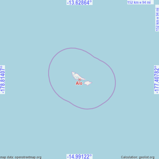
Alo GPS coordinates[2]
14° 18' 39.456" South, 178° 6' 39.384" West
| Map corner | latitude | longitude |
|---|---|---|
| Upper-left | -13.62864°, | -178.81407° |
| Center: | -14.31096°, | -178.11094° |
| Lower-right: | -14.99122°, | -177.40782° |
| Map W x H: | 151.5×151.5 km | = 94.1×94.1mi |
| max Lat: | -13.227° ⇑100% North |
| Alo: | -14.31096° |
| min Lat: | ⇓0% South -14.31096° |
| min Long | Alo | max Long |
| -178.15833° | -178.11094° | -176.16586° |
| W 11.1%⇐ | ⇒88.9% E |
Elevation
Elevation of Alo is 10 m = 33 ft, and this is 4 m = 13 ft below average elevation for this country.
| Max E: |
27 m = 89 ft | 77.8% |
| Avg. | 14 m = 46 ft | |
| Alo | 10 m = 33 ft | |
Min E: |
7 m = 23 ft | 22.2% |
See also: Wallis and Futuna elevation on elevation.city.
Geographical zone
Alo is located in South Torrid zone (between Equator and Tropic of Capricorn). Distance of this Southern Tropic circle is 1014.7 km =630.5 mi to South.| Distance of | km | miles | from Alo |
|---|---|---|---|
| Equator | 1591.2 | 988.7 | to North |
| Tropic Capricorn | 1014.7 | 630.5 | to South |
| Antarctic Circle | 5809.9 | 3610.1 | to South |
| South Pole | 8415.8 | 5229.3 | to South |


Nearby cities:
9 places around Alo: (largest is in red/bold)
• Akaka
239 km =148.5 mi,  61°
61°
• Alele
239.4 km =148.8 mi, 60°
• Falaleu
236.9 km =147.2 mi, 61°
• Halalo
231.2 km =143.7 mi, 62°
• Leava
5.5 km =3.4 mi,  291°
291°
• Liku
239.9 km =149.1 mi, 61°
• Mata-Utu
238.4 km =148.1 mi, 61°
• Utufua
233.3 km =145 mi, 62°
• Vaitupu
240.1 km =149.2 mi, 59°
Sources, notices
• [Note1] Compared only with cities in Wallis and Futuna existing in our database
• [Src1] Map data: © OpenStreetMap contributors (CC-BY-SA)
• [Src2] Other city data from geonames.org with taken over terms of usage.
• [Src3] Geographical zone / Annual Mean Temperature by Robert A. Rohde @ Wikipedia
