Salepou‘a‘e geodata
Salepou‘a‘e is a populated place; located in Samoa in Pacific/Apia (GMT+13) time zone. With population of 774 people, there are 31 cities with bigger population in this country. Compared to other cities in Samoa, 60.7% of cities are located further ↓South; 52.5% of cities are located further ←West and 100% of cities have higher elevation than Salepou‘a‘e. Note1


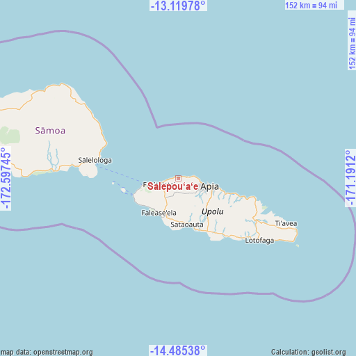
Salepou‘a‘e GPS coordinates[2]
13° 48' 12.888" South, 171° 53' 39.552" West
| Map corner | latitude | longitude |
|---|---|---|
| Upper-left | -13.11978°, | -172.59745° |
| Center: | -13.80358°, | -171.89432° |
| Lower-right: | -14.48538°, | -171.1912° |
| Map W x H: | 151.8×151.8 km | = 94.3×94.3mi |
| max Lat: | -13.44894° ⇑39.3% North |
| Salepou‘a‘e: | -13.80358° |
| min Lat: | ⇓60.7% South -14.04454° |
| min Long | Salepou‘a‘e | max Long |
| -172.69436° | -171.89432° | -171.42559° |
| W 52.5%⇐ | ⇒47.5% E |
Elevation
Elevation of Salepou‘a‘e is 7 m = 23 ft, and this is 16.9 m = 55 ft below average elevation for this country.
| Max E: |
252 m = 827 ft | 100% |
| Avg. | 23.9 m = 78 ft | |
| Salepou‘a‘e | 7 m = 23 ft | |
Min E: |
7 m = 23 ft | 0% |
See also: Samoa elevation on elevation.city.
Geographical zone
Salepou‘a‘e is located in South Torrid zone (between Equator and Tropic of Capricorn). Distance of this Southern Tropic circle is 1071.1 km =665.6 mi to South.| Distance of | km | miles | from Salepou‘a‘e |
|---|---|---|---|
| Equator | 1534.8 | 953.7 | to North |
| Tropic Capricorn | 1071.1 | 665.6 | to South |
| Antarctic Circle | 5866.4 | 3645.2 | to South |
| South Pole | 8472.2 | 5264.4 | to South |


Nearby cities:
15 places around Salepou‘a‘e: (largest is in red/bold)
• Afega
4.5 km =2.8 mi,  81°
81°
• Faleatiu
9.6 km =6 mi,  252°
252°
• Faleula
6.9 km =4.3 mi, 81°
• Fasito‘outa
5.1 km =3.2 mi,  259°
259°
• Lepea
11.8 km =7.3 mi,  107°
107°
• Leulumoega
7.5 km =4.7 mi, 253°
• Malie
5.1 km =3.2 mi,  86°
86°
• Nofoali‘i
7.2 km =4.5 mi, 253°
• Sapulu
3 km =1.9 mi,  267°
267°
• Satapuala
9.9 km =6.2 mi, 249°
• Siusega
9.8 km =6.1 mi,  117°
117°
• Toamua
8.9 km =5.5 mi, 93°
• Tufulele
2.3 km =1.4 mi, 266°
• Vaigaga
11 km =6.8 mi,  101°
101°
• Vaiusu
11.2 km =7 mi, 103°
Sources, notices
• [Note1] Compared only with cities in Samoa existing in our database
• [Src1] Map data: © OpenStreetMap contributors (CC-BY-SA)
• [Src2] Other city data from geonames.org with taken over terms of usage.
• [Src3] Geographical zone / Annual Mean Temperature by Robert A. Rohde @ Wikipedia
