Satapuala geodata
Satapuala (A'ana) is a populated place; located in Samoa in Pacific/Apia (GMT+13) time zone. With population of 1,412 people, there are 13 cities with bigger population in this country. Compared to other cities in Samoa, 59% of cities are located further ↑North; 59% of cities are located further →East and 88.5% of cities have lower elevation than Satapuala. Note1


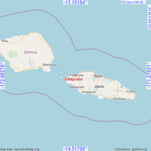
Satapuala GPS coordinates[2]
13° 50' 7.26" South, 171° 58' 46.668" West
| Map corner | latitude | longitude |
|---|---|---|
| Upper-left | -13.15164°, | -172.68276° |
| Center: | -13.83535°, | -171.97963° |
| Lower-right: | -14.51706°, | -171.27651° |
| Map W x H: | 151.8×151.8 km | = 94.3×94.3mi |
| max Lat: | -13.44894° ⇑59% North |
| Satapuala: | -13.83535° |
| min Lat: | ⇓41% South -14.04454° |
| min Long | Satapuala | max Long |
| -172.69436° | -171.97963° | -171.42559° |
| W 41%⇐ | ⇒59% E |
Elevation
Elevation of Satapuala is 38 m = 125 ft, and this is 14.1 m = 46 ft above average elevation for this country.
| Max E: |
252 m = 827 ft | 11.5% |
| Satapuala | 38 m 125 ft | |
| Avg. | 23.9 m = 78 ft | |
Min E: |
7 m = 23 ft | 88.5% |
See also: Samoa elevation on elevation.city.
Geographical zone
Satapuala is located in South Torrid zone (between Equator and Tropic of Capricorn). Distance of this Southern Tropic circle is 1067.6 km =663.4 mi to South.| Distance of | km | miles | from Satapuala |
|---|---|---|---|
| Equator | 1538.3 | 955.9 | to North |
| Tropic Capricorn | 1067.6 | 663.4 | to South |
| Antarctic Circle | 5862.8 | 3643 | to South |
| South Pole | 8468.7 | 5262.2 | to South |


Nearby cities:
15 places around Satapuala: (largest is in red/bold)
• Afega
14.3 km =8.9 mi,  72°
72°
• Faleatiu
0.7 km =0.4 mi,  5°
5°
• Faleula
16.6 km =10.3 mi, 74°
• Fasito‘outa
5 km =3.1 mi,  57°
57°
• Leulumoega
2.4 km =1.5 mi, 55°
• Levī
9.3 km =5.8 mi,  201°
201°
• Malie
14.8 km =9.2 mi, 74°
• Mulifanua
6.1 km =3.8 mi,  273°
273°
• Nofoali‘i
2.7 km =1.7 mi, 56°
• Pata
9.6 km =6 mi,  208°
208°
• Salepou‘a‘e
9.9 km =6.2 mi, 69°
• Samatau
11 km =6.8 mi,  229°
229°
• Sapulu
7.1 km =4.4 mi, 61°
• Siusega
17.9 km =11.1 mi,  93°
93°
• Tufulele
7.7 km =4.8 mi, 63°
Sources, notices
• [Note1] Compared only with cities in Samoa existing in our database
• [Src1] Map data: © OpenStreetMap contributors (CC-BY-SA)
• [Src2] Other city data from geonames.org with taken over terms of usage.
• [Src3] Geographical zone / Annual Mean Temperature by Robert A. Rohde @ Wikipedia
