Pozhar geodata
Pozhar (Gjakova) is a populated locality; located in Kosovo in Europe/Belgrade (GMT+2) time zone. With population of 700 people, there are 60 cities with bigger population in this country. Compared to other cities in Kosovo, 50.8% of cities are located further ↓South; 73.8% of cities are located further →East and 53.8% of cities have higher elevation than Pozhar. Note1


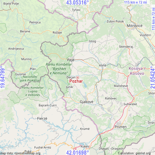
Pozhar GPS coordinates[2]
42° 32' 13.992" North, 20° 21' 3.996" East
| Map corner | latitude | longitude |
|---|---|---|
| Upper-left | 43.05316°, | 19.64799° |
| Center: | 42.53722°, | 20.35111° |
| Lower-right: | 42.01698°, | 21.05424° |
| Map W x H: | 115.2×115.2 km | = 71.6×71.6mi |
| max Lat: | 43.10389° ⇑49.2% North |
| Pozhar: | 42.53722° |
| min Lat: | ⇓50.8% South 42.0265° |
| min Long | Pozhar | max Long |
| 20.27722° | 20.35111° | 21.59889° |
| W 26.2%⇐ | ⇒73.8% E |
Elevation
Elevation of Pozhar is 533 m = 1749 ft, and this is 11.6 m = 38 ft below average elevation for this country.
| Max E: |
1062 m = 3484 ft | 53.8% |
| Avg. | 544.6 m = 1787 ft | |
| Pozhar | 533 m = 1749 ft | |
Min E: |
333 m = 1093 ft | 46.2% |
See also: Kosovo elevation on elevation.city.
Geographical zone
Pozhar is located in North temperate zone (between Tropic of Cancer and the Arctic Circle). Distance of this Northern Tropic circle is 2123.8 km =1319.7 mi to South.| Distance of | km | miles | from Pozhar |
|---|---|---|---|
| North Pole | 5277.4 | 3279.2 | to North |
| Arctic Circle | 2671.5 | 1660 | to North |
| Tropic Cancer | 2123.8 | 1319.7 | to South |
| Equator | 4729.7 | 2938.9 | to South |


Nearby cities:
15 places around Pozhar: (largest is in red/bold)
• Deçan
5.2 km =3.2 mi,  273°
273°
• Dranoc
5.4 km =3.4 mi,  243°
243°
• Gllogjan
3.5 km =2.2 mi,  164°
164°
• Irzniq
1.9 km =1.2 mi,  189°
189°
• Isniq
4.6 km =2.9 mi,  299°
299°
• Lloqan
5.9 km =3.7 mi,  256°
256°
• Lluka e Eperme
3.7 km =2.3 mi,  283°
283°
• Lluka e Poshtme
1.6 km =1 mi,  306°
306°
• Lumbardhi
1.1 km =0.7 mi,  340°
340°
• Lëbushë
5.7 km =3.5 mi, 300°
• Papraqan
2.4 km =1.5 mi,  316°
316°
• Prilep
4.3 km =2.7 mi,  219°
219°
• Shaptej
4.9 km =3 mi,  152°
152°
• Slup
6.5 km =4 mi, 240°
• Strellc i Ulët
5.6 km =3.5 mi,  329°
329°
Sources, notices
• [Note1] Compared only with cities in Kosovo existing in our database
• [Src1] Map data: © OpenStreetMap contributors (CC-BY-SA)
• [Src2] Other city data from geonames.org with taken over terms of usage.
• [Src3] Geographical zone / Annual Mean Temperature by Robert A. Rohde @ Wikipedia
