Canillo geodata
Canillo is a seat of a first-order administrative division; located in Andorra in Europe/Andorra (GMT+2) time zone. With population of 3,292 people, there are 5 cities with bigger population in this country. Compared to other cities in Andorra, 72.7% of cities are located further ↓South; 72.7% of cities are located further ←West and 72.7% of cities have lower elevation than Canillo. Note1


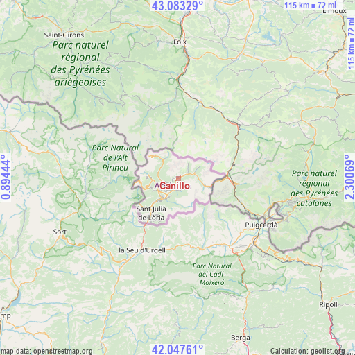
Canillo GPS coordinates[2]
42° 34' 3.36" North, 1° 35' 51.216" East
| Map corner | latitude | longitude |
|---|---|---|
| Upper-left | 43.08329°, | 0.89444° |
| Center: | 42.5676°, | 1.59756° |
| Lower-right: | 42.04761°, | 2.30069° |
| Map W x H: | 115.2×115.2 km | = 71.6×71.6mi |
| max Lat: | 42.57952° ⇑27.3% North |
| Canillo: | 42.5676° |
| min Lat: | ⇓72.7% South 42.46372° |
| min Long | Canillo | max Long |
| 1.48453° | 1.59756° | 1.73361° |
| W 72.7%⇐ | ⇒27.3% E |
Elevation
Elevation of Canillo is 1561 m = 5121 ft, and this is 163.5 m = 536 ft above average elevation for this country.
| Max E: |
2106 m = 6909 ft | 27.3% |
| Canillo | 1561 m 5121 ft | |
| Avg. | 1397.5 m = 4585 ft | |
Min E: |
921 m = 3022 ft | 72.7% |
See also: Andorra elevation on elevation.city.
Geographical zone
Canillo is located in North temperate zone (between Tropic of Cancer and the Arctic Circle). Distance of this Northern Tropic circle is 2127.2 km =1321.8 mi to South.| Distance of | km | miles | from Canillo |
|---|---|---|---|
| North Pole | 5274 | 3277.1 | to North |
| Arctic Circle | 2668.1 | 1657.9 | to North |
| Tropic Cancer | 2127.2 | 1321.8 | to South |
| Equator | 4733.1 | 2941 | to South |


Nearby cities:
11 places around Canillo: (largest is in red/bold)
• Andorra la Vella
9.1 km =5.7 mi,  223°
223°
• Arinsal
9.3 km =5.8 mi,  273°
273°
• El Tarter
4.8 km =3 mi,  73°
73°
• Encamp
3.9 km =2.4 mi,  201°
201°
• Ordino
5.4 km =3.4 mi,  256°
256°
• Pas de la Casa
11.5 km =7.1 mi,  103°
103°
• Sant Julià de Lòria
14.5 km =9 mi, 217°
• Soldeu
5.8 km =3.6 mi,  79°
79°
• l'Aldosa
6.7 km =4.2 mi,  246°
246°
• la Massana
7.2 km =4.5 mi, 249°
• les Escaldes
8.5 km =5.3 mi, 217°
Sources, notices
• [Note1] Compared only with cities in Andorra existing in our database
• [Src1] Map data: © OpenStreetMap contributors (CC-BY-SA)
• [Src2] Other city data from geonames.org with taken over terms of usage.
• [Src3] Geographical zone / Annual Mean Temperature by Robert A. Rohde @ Wikipedia
