Sandy Hill geodata
Sandy Hill is a seat of a first-order administrative division; located in Anguilla in America/Anguilla (GMT-4) time zone. In our database, there are 3 cities with bigger population. Compared to other cities in Anguilla, 76.9% of cities are located further ↓South; 84.6% of cities are located further ←West and 69.2% of cities have higher elevation than Sandy Hill. Note1


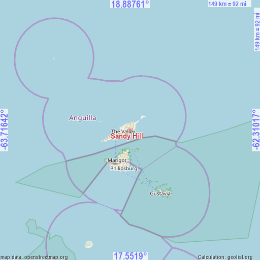
Sandy Hill GPS coordinates[2]
18° 13' 15.744" North, 63° 0' 47.844" West
| Map corner | latitude | longitude |
|---|---|---|
| Upper-left | 18.88761°, | -63.71642° |
| Center: | 18.22104°, | -63.01329° |
| Lower-right: | 17.5519°, | -62.31017° |
| Map W x H: | 148.5×148.5 km | = 92.3×92.3mi |
| max Lat: | 18.25601° ⇑23.1% North |
| Sandy Hill: | 18.22104° |
| min Lat: | ⇓76.9% South 18.17191° |
| min Long | Sandy Hill | max Long |
| -63.14941° | -63.01329° | -63° |
| W 84.6%⇐ | ⇒15.4% E |
Elevation
Elevation of Sandy Hill is 18 m = 59 ft, and this is 4.8 m = 16 ft below average elevation for this country.
| Max E: |
40 m = 131 ft | 69.2% |
| Avg. | 22.8 m = 75 ft | |
| Sandy Hill | 18 m = 59 ft | |
Min E: |
4 m = 13 ft | 30.8% |
See also: Anguilla elevation on elevation.city.
Geographical zone
Sandy Hill is located in North Torrid zone (between Equator and Tropic of Cancer). Distance of this Northern Tropic circle is 579.9 km =360.3 mi to North.| Distance of | km | miles | from Sandy Hill |
|---|---|---|---|
| North Pole | 7981.1 | 4959.2 | to North |
| Arctic Circle | 5375.2 | 3340 | to North |
| Tropic Cancer | 579.9 | 360.3 | to North |
| Equator | 2026 | 1258.9 | to South |


Nearby cities:
13 places around Sandy Hill: (largest is in red/bold)
• Blowing Point Village
9.8 km =6.1 mi,  239°
239°
• East End Village
2 km =1.2 mi,  45°
45°
• Farrington
1.2 km =0.7 mi, 235°
• George Hill
6.1 km =3.8 mi,  246°
246°
• Island Harbour
3.9 km =2.4 mi,  4°
4°
• North Hill Village
7.1 km =4.4 mi,  255°
255°
• North Side
3.4 km =2.1 mi,  285°
285°
• Sandy Ground Village
8.4 km =5.2 mi, 254°
• South Hill Village
8.5 km =5.3 mi, 247°
• Stoney Ground
3.5 km =2.2 mi,  268°
268°
• The Quarter
3.3 km =2.1 mi, 244°
• The Valley
4.7 km =2.9 mi, 264°
• West End Village
15.4 km =9.6 mi, 249°
Sources, notices
• [Note1] Compared only with cities in Anguilla existing in our database
• [Src1] Map data: © OpenStreetMap contributors (CC-BY-SA)
• [Src2] Other city data from geonames.org with taken over terms of usage.
• [Src3] Geographical zone / Annual Mean Temperature by Robert A. Rohde @ Wikipedia
