Rrogozhinë geodata
Rrogozhinë (Tirana) is a seat of a third-order administrative division; located in Albania in Europe/Tirane (GMT+2) time zone. With population of 5,620 people, there are 43 cities with bigger population in this country. Compared to other cities in Albania, 52.7% of cities are located further ↓South; 80.6% of cities are located further →East and 86.5% of cities have higher elevation than Rrogozhinë. Note1


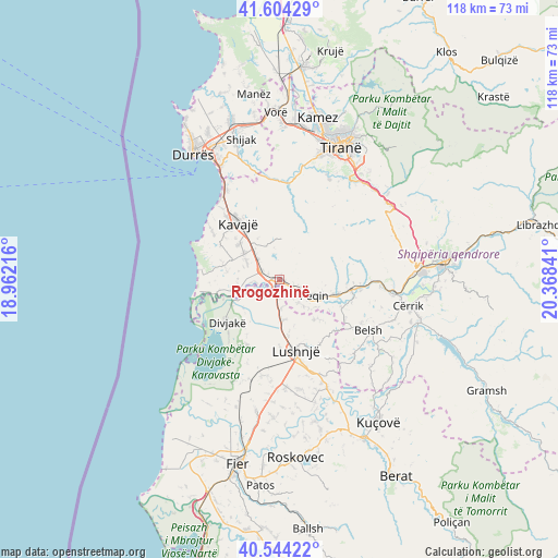
Rrogozhinë GPS coordinates[2]
41° 4' 35.004" North, 19° 39' 55.008" East
| Map corner | latitude | longitude |
|---|---|---|
| Upper-left | 41.60429°, | 18.96216° |
| Center: | 41.07639°, | 19.66528° |
| Lower-right: | 40.54422°, | 20.36841° |
| Map W x H: | 117.9×117.9 km | = 73.3×73.3mi |
| max Lat: | 42.45139° ⇑47.3% North |
| Rrogozhinë: | 41.07639° |
| min Lat: | ⇓52.7% South 39.65889° |
| min Long | Rrogozhinë | max Long |
| 19.40556° | 19.66528° | 20.99° |
| W 19.4%⇐ | ⇒80.6% E |
Elevation
Elevation of Rrogozhinë is 22 m = 72 ft, and this is 352.6 m = 1157 ft below average elevation for this country.
| Max E: |
1352 m = 4436 ft | 86.5% |
| Avg. | 374.6 m = 1229 ft | |
| Rrogozhinë | 22 m = 72 ft | |
Min E: |
-2 m = -7 ft | 13.5% |
See also: Albania elevation on elevation.city.
Geographical zone
Rrogozhinë is located in North temperate zone (between Tropic of Cancer and the Arctic Circle). Distance of this Northern Tropic circle is 1961.3 km =1218.7 mi to South.| Distance of | km | miles | from Rrogozhinë |
|---|---|---|---|
| North Pole | 5439.8 | 3380.1 | to North |
| Arctic Circle | 2833.9 | 1760.9 | to North |
| Tropic Cancer | 1961.3 | 1218.7 | to South |
| Equator | 4567.3 | 2838 | to South |


Nearby cities:
15 places around Rrogozhinë: (largest is in red/bold)
• Ballagat
12.3 km =7.6 mi,  137°
137°
• Divjakë
14.4 km =8.9 mi,  232°
232°
• Gjoçaj
7.5 km =4.7 mi, 138°
• Golem
12.2 km =7.6 mi,  172°
172°
• Gosë e Madhe
3.7 km =2.3 mi,  294°
294°
• Helmas
12.5 km =7.8 mi,  337°
337°
• Karinë
4.5 km =2.8 mi,  109°
109°
• Kryevidh
11.9 km =7.4 mi,  283°
283°
• Lekaj
6.3 km =3.9 mi,  312°
312°
• Luzi i Vogël
9.5 km =5.9 mi, 306°
• Peqin
7.9 km =4.9 mi,  115°
115°
• Përparim
11.6 km =7.2 mi,  104°
104°
• Shezë
13.9 km =8.6 mi, 114°
• Sinaballaj
3 km =1.9 mi, 106°
• Tërbuf
5.9 km =3.7 mi, 226°
Sources, notices
• [Note1] Compared only with cities in Albania existing in our database
• [Src1] Map data: © OpenStreetMap contributors (CC-BY-SA)
• [Src2] Other city data from geonames.org with taken over terms of usage.
• [Src3] Geographical zone / Annual Mean Temperature by Robert A. Rohde @ Wikipedia
