Peqin geodata
Peqin (Elbasan) is a seat of a second-order administrative division; located in Albania in Europe/Tirane (GMT+2) time zone. With population of 7,513 people, there are 38 cities with bigger population in this country. Compared to other cities in Albania, 50.1% of cities are located further ↓South; 70.7% of cities are located further →East and 75.5% of cities have higher elevation than Peqin. Note1


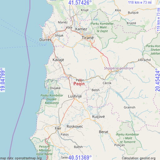
Peqin GPS coordinates[2]
41° 2' 45.996" North, 19° 45' 3.996" East
| Map corner | latitude | longitude |
|---|---|---|
| Upper-left | 41.57426°, | 19.04799° |
| Center: | 41.04611°, | 19.75111° |
| Lower-right: | 40.51369°, | 20.45424° |
| Map W x H: | 117.9×117.9 km | = 73.3×73.3mi |
| max Lat: | 42.45139° ⇑49.9% North |
| Peqin: | 41.04611° |
| min Lat: | ⇓50.1% South 39.65889° |
| min Long | Peqin | max Long |
| 19.40556° | 19.75111° | 20.99° |
| W 29.3%⇐ | ⇒70.7% E |
Elevation
Elevation of Peqin is 52 m = 171 ft, and this is 322.6 m = 1058 ft below average elevation for this country.
| Max E: |
1352 m = 4436 ft | 75.5% |
| Avg. | 374.6 m = 1229 ft | |
| Peqin | 52 m = 171 ft | |
Min E: |
-2 m = -7 ft | 24.5% |
See also: Albania elevation on elevation.city.
Geographical zone
Peqin is located in North temperate zone (between Tropic of Cancer and the Arctic Circle). Distance of this Northern Tropic circle is 1958 km =1216.6 mi to South.| Distance of | km | miles | from Peqin |
|---|---|---|---|
| North Pole | 5443.2 | 3382.2 | to North |
| Arctic Circle | 2837.3 | 1763 | to North |
| Tropic Cancer | 1958 | 1216.6 | to South |
| Equator | 4563.9 | 2835.9 | to South |


Nearby cities:
15 places around Peqin: (largest is in red/bold)
• Ballagat
5.8 km =3.6 mi,  168°
168°
• Belsh
13.5 km =8.4 mi,  125°
125°
• Gjoçaj
3.2 km =2 mi,  224°
224°
• Golem
10.3 km =6.4 mi,  212°
212°
• Gosë e Madhe
11.7 km =7.3 mi,  295°
295°
• Hysgjokaj
8.9 km =5.5 mi,  158°
158°
• Karinë
3.5 km =2.2 mi, 302°
• Lushnjë
12.2 km =7.6 mi,  198°
198°
• Pajovë
7.3 km =4.5 mi,  82°
82°
• Përparim
4.1 km =2.5 mi, 83°
• Rrasa e Sipërme
10.5 km =6.5 mi,  146°
146°
• Rrogozhinë
7.9 km =4.9 mi, 295°
• Shezë
6 km =3.7 mi,  114°
114°
• Sinaballaj
5 km =3.1 mi, 300°
• Tërbuf
11.5 km =7.1 mi,  266°
266°
Sources, notices
• [Note1] Compared only with cities in Albania existing in our database
• [Src1] Map data: © OpenStreetMap contributors (CC-BY-SA)
• [Src2] Other city data from geonames.org with taken over terms of usage.
• [Src3] Geographical zone / Annual Mean Temperature by Robert A. Rohde @ Wikipedia
