Frakulla e Madhe geodata
Frakulla e Madhe (Fier) is a seat of a third-order administrative division; located in Albania in Europe/Tirane (GMT+2) time zone. In our database, there are 71 cities with bigger population. Compared to other cities in Albania, 74.6% of cities are located further ↑North; 96.1% of cities are located further →East and 88.5% of cities have higher elevation than Frakulla e Madhe. Note1


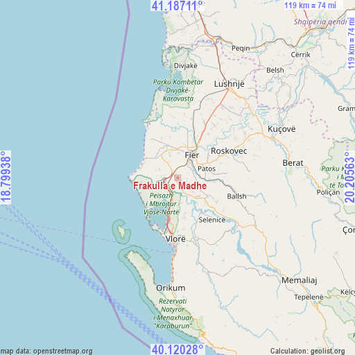
Frakulla e Madhe GPS coordinates[2]
40° 39' 20.988" North, 19° 30' 9" East
| Map corner | latitude | longitude |
|---|---|---|
| Upper-left | 41.18711°, | 18.79938° |
| Center: | 40.65583°, | 19.5025° |
| Lower-right: | 40.12028°, | 20.20563° |
| Map W x H: | 118.6×118.6 km | = 73.7×73.7mi |
| max Lat: | 42.45139° ⇑74.6% North |
| Frakulla e Madhe: | 40.65583° |
| min Lat: | ⇓25.4% South 39.65889° |
| min Long | Frakulla e Madh | max Long |
| 19.40556° | 19.5025° | 20.99° |
| W 3.9%⇐ | ⇒96.1% E |
Elevation
Elevation of Frakulla e Madhe is 19 m = 62 ft, and this is 355.6 m = 1167 ft below average elevation for this country.
| Max E: |
1352 m = 4436 ft | 88.5% |
| Avg. | 374.6 m = 1229 ft | |
| Frakulla e Madhe | 19 m = 62 ft | |
Min E: |
-2 m = -7 ft | 11.5% |
See also: Albania elevation on elevation.city.
Geographical zone
Frakulla e Madhe is located in North temperate zone (between Tropic of Cancer and the Arctic Circle). Distance of this Northern Tropic circle is 1914.6 km =1189.7 mi to South.| Distance of | km | miles | from Frakulla e Madhe |
|---|---|---|---|
| North Pole | 5486.6 | 3409.2 | to North |
| Arctic Circle | 2880.7 | 1790 | to North |
| Tropic Cancer | 1914.6 | 1189.7 | to South |
| Equator | 4520.5 | 2808.9 | to South |


Nearby cities:
15 places around Frakulla e Madhe: (largest is in red/bold)
• Armen
15.5 km =9.6 mi,  149°
149°
• Cakran
12 km =7.5 mi,  119°
119°
• Dërmënas
10 km =6.2 mi,  355°
355°
• Fier
8.8 km =5.5 mi,  30°
30°
• Fier-Çifçi
8.7 km =5.4 mi,  38°
38°
• Kuman
17.4 km =10.8 mi,  63°
63°
• Levan
2.5 km =1.6 mi,  334°
334°
• Mbrostar-Urë
12.7 km =7.9 mi, 30°
• Novoselë
4.6 km =2.9 mi,  221°
221°
• Patos
10.3 km =6.4 mi,  72°
72°
• Patos Fshat
12.6 km =7.8 mi,  96°
96°
• Portëz
7.7 km =4.8 mi,  51°
51°
• Ruzhdie
16.6 km =10.3 mi,  84°
84°
• Topojë
13.3 km =8.3 mi, 333°
• Zharrëz
13.8 km =8.6 mi, 64°
Sources, notices
• [Note1] Compared only with cities in Albania existing in our database
• [Src1] Map data: © OpenStreetMap contributors (CC-BY-SA)
• [Src2] Other city data from geonames.org with taken over terms of usage.
• [Src3] Geographical zone / Annual Mean Temperature by Robert A. Rohde @ Wikipedia
