Balldreni i Ri geodata
Balldreni i Ri (Lezhë) is a seat of a third-order administrative division; located in Albania in Europe/Tirane (GMT+2) time zone. In our database, there are 71 cities with bigger population. Compared to other cities in Albania, 83.7% of cities are located further ↓South; 83.4% of cities are located further →East and 86.5% of cities have higher elevation than Balldreni i Ri. Note1


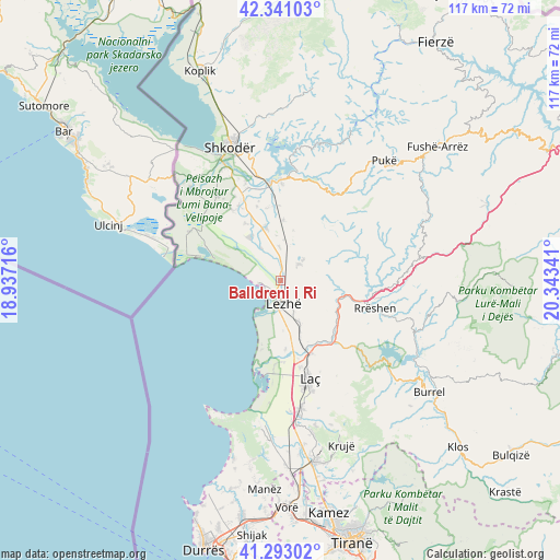
Balldreni i Ri GPS coordinates[2]
41° 49' 9.012" North, 19° 38' 25.008" East
| Map corner | latitude | longitude |
|---|---|---|
| Upper-left | 42.34103°, | 18.93716° |
| Center: | 41.81917°, | 19.64028° |
| Lower-right: | 41.29302°, | 20.34341° |
| Map W x H: | 116.5×116.5 km | = 72.4×72.4mi |
| max Lat: | 42.45139° ⇑16.3% North |
| Balldreni i Ri: | 41.81917° |
| min Lat: | ⇓83.7% South 39.65889° |
| min Long | Balldreni i Ri | max Long |
| 19.40556° | 19.64028° | 20.99° |
| W 16.6%⇐ | ⇒83.4% E |
Elevation
Elevation of Balldreni i Ri is 22 m = 72 ft, and this is 352.6 m = 1157 ft below average elevation for this country.
| Max E: |
1352 m = 4436 ft | 86.5% |
| Avg. | 374.6 m = 1229 ft | |
| Balldreni i Ri | 22 m = 72 ft | |
Min E: |
-2 m = -7 ft | 13.5% |
See also: Albania elevation on elevation.city.
Geographical zone
Balldreni i Ri is located in North temperate zone (between Tropic of Cancer and the Arctic Circle). Distance of this Northern Tropic circle is 2043.9 km =1270 mi to South.| Distance of | km | miles | from Balldreni i Ri |
|---|---|---|---|
| North Pole | 5357.2 | 3328.8 | to North |
| Arctic Circle | 2751.3 | 1709.6 | to North |
| Tropic Cancer | 2043.9 | 1270 | to South |
| Equator | 4649.9 | 2889.3 | to South |


Nearby cities:
15 places around Balldreni i Ri: (largest is in red/bold)
• Dajç
11.1 km =6.9 mi,  344°
344°
• Fushëkuqe
18.9 km =11.7 mi,  185°
185°
• Hajmel
14.9 km =9.3 mi,  359°
359°
• Kallmeti i Madh
5.1 km =3.2 mi,  49°
49°
• Kolç
4.7 km =2.9 mi,  140°
140°
• Laç
21.3 km =13.2 mi,  163°
163°
• Lezhë
4 km =2.5 mi,  176°
176°
• Milot
16.3 km =10.1 mi, 157°
• Rrëshen
20.3 km =12.6 mi,  106°
106°
• Rubik
13.1 km =8.1 mi, 112°
• Shëngjin
3.9 km =2.4 mi,  260°
260°
• Shënkoll
14.3 km =8.9 mi, 175°
• Ungrej
14.2 km =8.8 mi,  64°
64°
• Velipojë
20.5 km =12.7 mi,  288°
288°
• Zejmen
13 km =8.1 mi, 161°
Sources, notices
• [Note1] Compared only with cities in Albania existing in our database
• [Src1] Map data: © OpenStreetMap contributors (CC-BY-SA)
• [Src2] Other city data from geonames.org with taken over terms of usage.
• [Src3] Geographical zone / Annual Mean Temperature by Robert A. Rohde @ Wikipedia
