Golaj geodata
Golaj (Kukës) is a seat of a third-order administrative division; located in Albania in Europe/Tirane (GMT+2) time zone. In our database, there are 71 cities with bigger population. Compared to other cities in Albania, 97.2% of cities are located further ↓South; 81.7% of cities are located further ←West and 65.9% of cities have lower elevation than Golaj. Note1


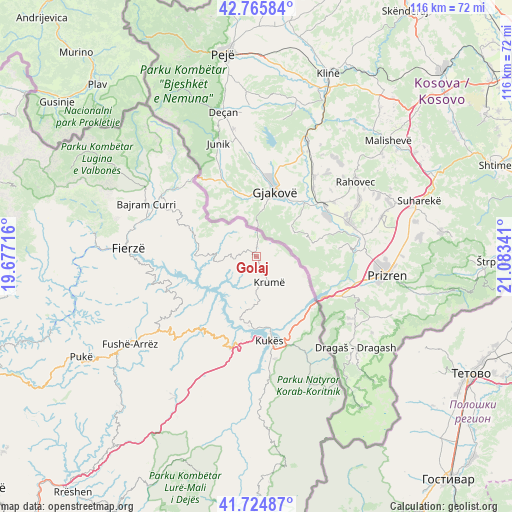
Golaj GPS coordinates[2]
42° 14' 51" North, 20° 22' 49.008" East
| Map corner | latitude | longitude |
|---|---|---|
| Upper-left | 42.76584°, | 19.67716° |
| Center: | 42.2475°, | 20.38028° |
| Lower-right: | 41.72487°, | 21.08341° |
| Map W x H: | 115.7×115.7 km | = 71.9×71.9mi |
| max Lat: | 42.45139° ⇑2.8% North |
| Golaj: | 42.2475° |
| min Lat: | ⇓97.2% South 39.65889° |
| min Long | Golaj | max Long |
| 19.40556° | 20.38028° | 20.99° |
| W 81.7%⇐ | ⇒18.3% E |
Elevation
Elevation of Golaj is 496 m = 1627 ft, and this is 121.4 m = 398 ft above average elevation for this country.
| Max E: |
1352 m = 4436 ft | 34.1% |
| Golaj | 496 m 1627 ft | |
| Avg. | 374.6 m = 1229 ft | |
Min E: |
-2 m = -7 ft | 65.9% |
See also: Albania elevation on elevation.city.
Geographical zone
Golaj is located in North temperate zone (between Tropic of Cancer and the Arctic Circle). Distance of this Northern Tropic circle is 2091.6 km =1299.7 mi to South.| Distance of | km | miles | from Golaj |
|---|---|---|---|
| North Pole | 5309.6 | 3299.2 | to North |
| Arctic Circle | 2703.7 | 1680 | to North |
| Tropic Cancer | 2091.6 | 1299.7 | to South |
| Equator | 4697.5 | 2918.9 | to South |


Nearby cities:
15 places around Golaj: (largest is in red/bold)
• Bajram Curri
27.8 km =17.3 mi,  296°
296°
• Bicaj
28.2 km =17.5 mi,  174°
174°
• Blerim
18.3 km =11.4 mi,  238°
238°
• Bujan
26.5 km =16.5 mi,  289°
289°
• Bytyç
16.2 km =10.1 mi, 295°
• Fajzë
9.3 km =5.8 mi,  195°
195°
• Gjinaj
15.1 km =9.4 mi,  162°
162°
• Kolsh
19.1 km =11.9 mi,  189°
189°
• Krumë
6.2 km =3.9 mi,  154°
154°
• Kukës
19.3 km =12 mi, 169°
• Llugaj
24.7 km =15.3 mi, 295°
• Shtiqën
23.4 km =14.5 mi, 169°
• Shënmëri
19.8 km =12.3 mi,  216°
216°
• Surroj
28.5 km =17.7 mi, 185°
• Zapod
26.1 km =16.2 mi, 147°
Sources, notices
• [Note1] Compared only with cities in Albania existing in our database
• [Src1] Map data: © OpenStreetMap contributors (CC-BY-SA)
• [Src2] Other city data from geonames.org with taken over terms of usage.
• [Src3] Geographical zone / Annual Mean Temperature by Robert A. Rohde @ Wikipedia
