Barmash geodata
Barmash (Korçë) is a seat of a third-order administrative division; located in Albania in Europe/Tirane (GMT+2) time zone. In our database, there are 71 cities with bigger population. Compared to other cities in Albania, 90.7% of cities are located further ↑North; 93.2% of cities are located further ←West and 89.9% of cities have lower elevation than Barmash. Note1


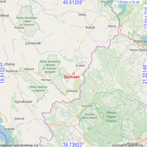
Barmash GPS coordinates[2]
40° 16' 40.008" North, 20° 37' 5.988" East
| Map corner | latitude | longitude |
|---|---|---|
| Upper-left | 40.81208°, | 19.91521° |
| Center: | 40.27778°, | 20.61833° |
| Lower-right: | 39.73923°, | 21.32146° |
| Map W x H: | 119.3×119.3 km | = 74.1×74.1mi |
| max Lat: | 42.45139° ⇑90.7% North |
| Barmash: | 40.27778° |
| min Lat: | ⇓9.3% South 39.65889° |
| min Long | Barmash | max Long |
| 19.40556° | 20.61833° | 20.99° |
| W 93.2%⇐ | ⇒6.8% E |
Elevation
Elevation of Barmash is 879 m = 2884 ft, and this is 504.4 m = 1655 ft above average elevation for this country.
| Max E: |
1352 m = 4436 ft | 10.1% |
| Barmash | 879 m 2884 ft | |
| Avg. | 374.6 m = 1229 ft | |
Min E: |
-2 m = -7 ft | 89.9% |
See also: Albania elevation on elevation.city.
Geographical zone
Barmash is located in North temperate zone (between Tropic of Cancer and the Arctic Circle). Distance of this Northern Tropic circle is 1872.6 km =1163.6 mi to South.| Distance of | km | miles | from Barmash |
|---|---|---|---|
| North Pole | 5528.6 | 3435.3 | to North |
| Arctic Circle | 2922.7 | 1816.1 | to North |
| Tropic Cancer | 1872.6 | 1163.6 | to South |
| Equator | 4478.5 | 2782.8 | to South |


Nearby cities:
15 places around Barmash: (largest is in red/bold)
• Ersekë
8.4 km =5.2 mi,  37°
37°
• Frashër
19.3 km =12 mi,  301°
301°
• Gjinkar
20 km =12.4 mi,  244°
244°
• Leskovik
14.2 km =8.8 mi,  187°
187°
• Mollaj
33.1 km =20.6 mi,  18°
18°
• Mollas
17.1 km =10.6 mi, 16°
• Petran
18.6 km =11.6 mi,  245°
245°
• Piskovë
29.3 km =18.2 mi,  270°
270°
• Potom
31.3 km =19.4 mi,  318°
318°
• Përmet
23.2 km =14.4 mi,  257°
257°
• Skore
28.6 km =17.8 mi,  228°
228°
• Vithkuq
27.7 km =17.2 mi,  353°
353°
• Vithkuq
31.5 km =19.6 mi, 255°
• Çarshovë
18.9 km =11.7 mi,  200°
200°
• Çlirim
16.6 km =10.3 mi,  339°
339°
Sources, notices
• [Note1] Compared only with cities in Albania existing in our database
• [Src1] Map data: © OpenStreetMap contributors (CC-BY-SA)
• [Src2] Other city data from geonames.org with taken over terms of usage.
• [Src3] Geographical zone / Annual Mean Temperature by Robert A. Rohde @ Wikipedia
