Dalar geodata
Dalar (Ararat) is a populated place; located in Armenia in Asia/Yerevan (GMT+4) time zone. With population of 2,504 people, there are 115 cities with bigger population in this country. Compared to other cities in Armenia, 84.1% of cities are located further ↑North; 50.6% of cities are located further →East and 87.3% of cities have higher elevation than Dalar. Note1


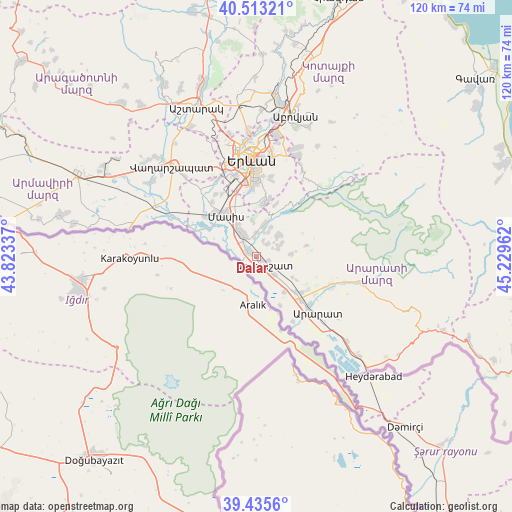
Dalar GPS coordinates[2]
39° 58' 35.508" North, 44° 31' 35.364" East
| Map corner | latitude | longitude |
|---|---|---|
| Upper-left | 40.51321°, | 43.82337° |
| Center: | 39.97653°, | 44.52649° |
| Lower-right: | 39.4356°, | 45.22962° |
| Map W x H: | 119.8×119.8 km | = 74.4×74.4mi |
| max Lat: | 41.24358° ⇑84.1% North |
| Dalar: | 39.97653° |
| min Lat: | ⇓15.9% South 38.90292° |
| min Long | Dalar | max Long |
| 43.74722° | 44.52649° | 46.5446° |
| W 49.4%⇐ | ⇒50.6% E |
Elevation
Elevation of Dalar is 839 m = 2753 ft, and this is 462.5 m = 1517 ft below average elevation for this country.
| Max E: |
2169 m = 7116 ft | 87.3% |
| Avg. | 1301.5 m = 4270 ft | |
| Dalar | 839 m = 2753 ft | |
Min E: |
440 m = 1444 ft | 12.7% |
See also: Armenia elevation on elevation.city.
Geographical zone
Dalar is located in North temperate zone (between Tropic of Cancer and the Arctic Circle). Distance of this Northern Tropic circle is 1839.1 km =1142.8 mi to South.| Distance of | km | miles | from Dalar |
|---|---|---|---|
| North Pole | 5562.1 | 3456.1 | to North |
| Arctic Circle | 2956.2 | 1836.9 | to North |
| Tropic Cancer | 1839.1 | 1142.8 | to South |
| Equator | 4445 | 2762 | to South |


Nearby cities:
15 places around Dalar: (largest is in red/bold)
• Artashat
2.3 km =1.4 mi,  137°
137°
• Aygepat
6.6 km =4.1 mi,  107°
107°
• Aygestan
4 km =2.5 mi,  42°
42°
• Berk’anush
0.8 km =0.5 mi,  280°
280°
• Burastan
3 km =1.9 mi,  303°
303°
• Byuravan
4.4 km =2.7 mi,  351°
351°
• Dimitrov
4.6 km =2.9 mi,  320°
320°
• Mrganush
6.4 km =4 mi,  25°
25°
• Mrgavan
0.9 km =0.6 mi,  119°
119°
• Mrgavet
6.8 km =4.2 mi,  327°
327°
• Norashen
6.3 km =3.9 mi,  64°
64°
• Nshavan
5.7 km =3.5 mi,  359°
359°
• Shahumyan
5.5 km =3.4 mi,  134°
134°
• Verin Artashat
5.8 km =3.6 mi,  66°
66°
• Vostan
3.1 km =1.9 mi, 114°
Sources, notices
• [Note1] Compared only with cities in Armenia existing in our database
• [Src1] Map data: © OpenStreetMap contributors (CC-BY-SA)
• [Src2] Other city data from geonames.org with taken over terms of usage.
• [Src3] Geographical zone / Annual Mean Temperature by Robert A. Rohde @ Wikipedia
