Zárate geodata
Zárate (Buenos Aires) is a seat of a second-order administrative division; located in Argentina in America/Argentina/Buenos_Aires (GMT-3) time zone. With population of 88,781 people, there are 44 cities with bigger population in this country. Compared to other cities in Argentina, 69.1% of cities are located further ↑North; 76.1% of cities are located further ←West and 90.3% of cities have higher elevation than Zárate. Note1


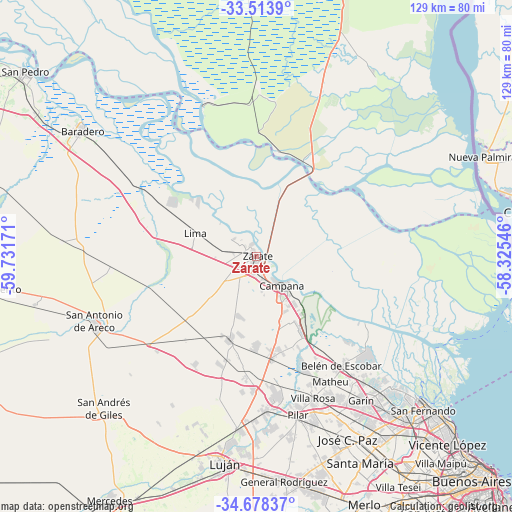
Zárate GPS coordinates[2]
34° 5' 53.304" South, 59° 1' 42.888" West
| Map corner | latitude | longitude |
|---|---|---|
| Upper-left | -33.5139°, | -59.73171° |
| Center: | -34.09814°, | -59.02858° |
| Lower-right: | -34.67837°, | -58.32546° |
| Map W x H: | 129.5×129.5 km | = 80.5×80.5mi |
| max Lat: | -21.94467° ⇑69.1% North |
| Zárate: | -34.09814° |
| min Lat: | ⇓30.9% South -54.81084° |
| min Long | Zárate | max Long |
| -72.88605° | -59.02858° | -53.64581° |
| W 76.1%⇐ | ⇒23.9% E |
Elevation
Elevation of Zárate is 28 m = 92 ft, and this is 321.3 m = 1054 ft below average elevation for this country.
| Max E: |
4040 m = 13255 ft | 90.3% |
| Avg. | 349.3 m = 1146 ft | |
| Zárate | 28 m = 92 ft | |
Min E: |
-2 m = -7 ft | 9.7% |
See also: Zárate elevation on elevation.city.
Geographical zone
Zárate is located in South temperate zone (between Tropic of Capricorn and the Antarctic Circle). Distance of this Southern Tropic circle is 1185.4 km =736.6 mi to North.| Distance of | km | miles | from Zárate |
|---|---|---|---|
| Equator | 3791.4 | 2355.9 | to North |
| Tropic Capricorn | 1185.4 | 736.6 | to North |
| Antarctic Circle | 3609.8 | 2243 | to South |
| South Pole | 6215.7 | 3862.3 | to South |


Nearby cities:
15 places around Zárate: (largest is in red/bold)
• Baradero
54.5 km =33.9 mi,  305°
305°
• Belén de Escobar
35.3 km =21.9 mi,  142°
142°
• Campana
9.7 km =6 mi, 138°
• Capilla del Señor
22.6 km =14 mi,  197°
197°
• General Pacheco
53 km =32.9 mi, 138°
• Ingeniero Pablo Nogués
51.5 km =32 mi, 144°
• José C. Paz
52.2 km =32.4 mi,  152°
152°
• Los Polvorines
53.9 km =33.5 mi, 146°
• Luján
53 km =32.9 mi,  187°
187°
• Pilar
41.4 km =25.7 mi,  165°
165°
• Puerto Ibicuy
40.8 km =25.4 mi,  340°
340°
• San Andrés de Giles
54.5 km =33.9 mi,  224°
224°
• San Antonio de Areco
44.1 km =27.4 mi,  247°
247°
• Santa Catalina - Dique Lujan
43.4 km =27 mi, 137°
• Tortuguitas
48.9 km =30.4 mi, 148°
Sources, notices
• [Note1] Compared only with cities in Argentina existing in our database
• [Src1] Map data: © OpenStreetMap contributors (CC-BY-SA)
• [Src2] Other city data from geonames.org with taken over terms of usage.
• [Src3] Geographical zone / Annual Mean Temperature by Robert A. Rohde @ Wikipedia
