Palo Santo geodata
Palo Santo (Formosa) is a populated place; located in Argentina in America/Argentina/Cordoba (GMT-3) time zone. With population of 5,324 people, there are 430 cities with bigger population in this country. Compared to other cities in Argentina, 93.4% of cities are located further ↓South; 73.5% of cities are located further ←West and 66.6% of cities have higher elevation than Palo Santo. Note1


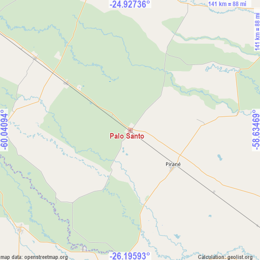
Palo Santo GPS coordinates[2]
25° 33' 47.952" South, 59° 20' 16.116" West
| Map corner | latitude | longitude |
|---|---|---|
| Upper-left | -24.92736°, | -60.04094° |
| Center: | -25.56332°, | -59.33781° |
| Lower-right: | -26.19593°, | -58.63469° |
| Map W x H: | 141.1×141.1 km | = 87.7×87.7mi |
| max Lat: | -21.94467° ⇑6.6% North |
| Palo Santo: | -25.56332° |
| min Lat: | ⇓93.4% South -54.81084° |
| min Long | Palo Santo | max Long |
| -72.88605° | -59.33781° | -53.64581° |
| W 73.5%⇐ | ⇒26.5% E |
Elevation
Elevation of Palo Santo is 90 m = 295 ft, and this is 259.3 m = 851 ft below average elevation for this country.
| Max E: |
4040 m = 13255 ft | 66.6% |
| Avg. | 349.3 m = 1146 ft | |
| Palo Santo | 90 m = 295 ft | |
Min E: |
-2 m = -7 ft | 33.4% |
See also: Argentina elevation on elevation.city.
Geographical zone
Palo Santo is located in South temperate zone (between Tropic of Capricorn and the Antarctic Circle). Distance of this Southern Tropic circle is 236.5 km =147 mi to North.| Distance of | km | miles | from Palo Santo |
|---|---|---|---|
| Equator | 2842.4 | 1766.2 | to North |
| Tropic Capricorn | 236.5 | 147 | to North |
| Antarctic Circle | 4558.8 | 2832.7 | to South |
| South Pole | 7164.7 | 4451.9 | to South |


Nearby cities:
15 places around Palo Santo: (largest is in red/bold)
• Ciervo Petiso
116.8 km =72.6 mi,  194°
194°
• Comandante Fontana
42.9 km =26.7 mi,  306°
306°
• El Colorado
82.9 km =51.5 mi,  182°
182°
• Espinillo
102.1 km =63.4 mi,  50°
50°
• Estanislao del Campo
94.6 km =58.8 mi, 306°
• General José de San Martín
108.3 km =67.3 mi, 180°
• Ibarreta
65.1 km =40.5 mi, 306°
• Laguna Limpia
109.2 km =67.9 mi,  198°
198°
• Pampa del Indio
80.8 km =50.2 mi,  227°
227°
• Pirané
29.7 km =18.5 mi,  129°
129°
• Pozo del Tigre
123.8 km =76.9 mi, 306°
• Presidencia Roca
69.2 km =43 mi, 201°
• Riacho Eh-Eh
108.8 km =67.6 mi,  78°
78°
• San Francisco de Laishí
103.5 km =64.3 mi,  136°
136°
• Villa General Guemes
91.1 km =56.6 mi,  350°
350°
Sources, notices
• [Note1] Compared only with cities in Argentina existing in our database
• [Src1] Map data: © OpenStreetMap contributors (CC-BY-SA)
• [Src2] Other city data from geonames.org with taken over terms of usage.
• [Src3] Geographical zone / Annual Mean Temperature by Robert A. Rohde @ Wikipedia
