Ibarreta geodata
Ibarreta (Formosa) is a populated place; located in Argentina in America/Argentina/Cordoba (GMT-3) time zone. With population of 8,687 people, there are 316 cities with bigger population in this country. Compared to other cities in Argentina, 94.5% of cities are located further ↓South; 69.1% of cities are located further ←West and 60.5% of cities have higher elevation than Ibarreta. Note1


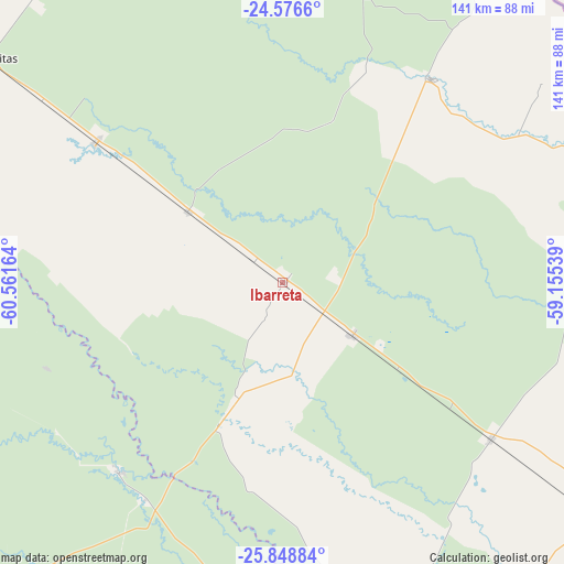
Ibarreta GPS coordinates[2]
25° 12' 51.768" South, 59° 51' 30.636" West
| Map corner | latitude | longitude |
|---|---|---|
| Upper-left | -24.5766°, | -60.56164° |
| Center: | -25.21438°, | -59.85851° |
| Lower-right: | -25.84884°, | -59.15539° |
| Map W x H: | 141.5×141.5 km | = 87.9×87.9mi |
| max Lat: | -21.94467° ⇑5.5% North |
| Ibarreta: | -25.21438° |
| min Lat: | ⇓94.5% South -54.81084° |
| min Long | Ibarreta | max Long |
| -72.88605° | -59.85851° | -53.64581° |
| W 69.1%⇐ | ⇒30.9% E |
Elevation
Elevation of Ibarreta is 107 m = 351 ft, and this is 242.3 m = 795 ft below average elevation for this country.
| Max E: |
4040 m = 13255 ft | 60.5% |
| Avg. | 349.3 m = 1146 ft | |
| Ibarreta | 107 m = 351 ft | |
Min E: |
-2 m = -7 ft | 39.5% |
See also: Argentina elevation on elevation.city.
Geographical zone
Ibarreta is located in South temperate zone (between Tropic of Capricorn and the Antarctic Circle). Distance of this Southern Tropic circle is 197.7 km =122.8 mi to North.| Distance of | km | miles | from Ibarreta |
|---|---|---|---|
| Equator | 2803.6 | 1742.1 | to North |
| Tropic Capricorn | 197.7 | 122.8 | to North |
| Antarctic Circle | 4597.6 | 2856.8 | to South |
| South Pole | 7203.5 | 4476 | to South |


Nearby cities:
15 places around Ibarreta: (largest is in red/bold)
• Castelli
111.6 km =69.3 mi,  223°
223°
• Ciervo Petiso
153.6 km =95.4 mi,  171°
171°
• Comandante Fontana
22.2 km =13.8 mi,  126°
126°
• El Colorado
131 km =81.4 mi,  158°
158°
• Espinillo
134.1 km =83.3 mi,  78°
78°
• Estanislao del Campo
29.4 km =18.3 mi,  306°
306°
• Laguna Limpia
143.6 km =89.2 mi, 172°
• Las Lomitas
92.9 km =57.7 mi, 307°
• Palo Santo
65.1 km =40.5 mi, 126°
• Pampa del Indio
93.2 km =57.9 mi,  184°
184°
• Pirané
94.8 km =58.9 mi, 127°
• Pozo del Tigre
58.7 km =36.5 mi, 307°
• Presidencia Roca
106.3 km =66.1 mi, 165°
• Tres Isletas
137.8 km =85.6 mi,  204°
204°
• Villa General Guemes
63.2 km =39.3 mi,  36°
36°
Sources, notices
• [Note1] Compared only with cities in Argentina existing in our database
• [Src1] Map data: © OpenStreetMap contributors (CC-BY-SA)
• [Src2] Other city data from geonames.org with taken over terms of usage.
• [Src3] Geographical zone / Annual Mean Temperature by Robert A. Rohde @ Wikipedia
