Comandante Fontana geodata
Comandante Fontana (Formosa) is a seat of a second-order administrative division; located in Argentina in America/Argentina/Cordoba (GMT-3) time zone. With population of 5,655 people, there are 410 cities with bigger population in this country. Compared to other cities in Argentina, 94.1% of cities are located further ↓South; 70.3% of cities are located further ←West and 61.7% of cities have higher elevation than Comandante Fontana. Note1


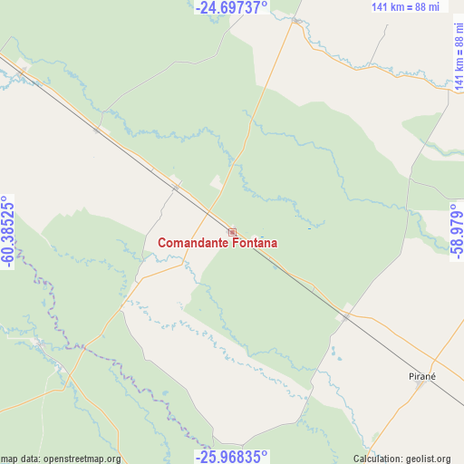
Comandante Fontana GPS coordinates[2]
25° 20' 4.308" South, 59° 40' 55.632" West
| Map corner | latitude | longitude |
|---|---|---|
| Upper-left | -24.69737°, | -60.38525° |
| Center: | -25.33453°, | -59.68212° |
| Lower-right: | -25.96835°, | -58.979° |
| Map W x H: | 141.3×141.3 km | = 87.8×87.8mi |
| max Lat: | -21.94467° ⇑5.9% North |
| Comandante Fontana: | -25.33453° |
| min Lat: | ⇓94.1% South -54.81084° |
| min Long | Comandante Font | max Long |
| -72.88605° | -59.68212° | -53.64581° |
| W 70.3%⇐ | ⇒29.7% E |
Elevation
Elevation of Comandante Fontana is 103 m = 338 ft, and this is 246.3 m = 808 ft below average elevation for this country.
| Max E: |
4040 m = 13255 ft | 61.7% |
| Avg. | 349.3 m = 1146 ft | |
| Comandante Fontana | 103 m = 338 ft | |
Min E: |
-2 m = -7 ft | 38.3% |
See also: Argentina elevation on elevation.city.
Geographical zone
Comandante Fontana is located in South temperate zone (between Tropic of Capricorn and the Antarctic Circle). Distance of this Southern Tropic circle is 211 km =131.1 mi to North.| Distance of | km | miles | from Comandante Fontana |
|---|---|---|---|
| Equator | 2816.9 | 1750.3 | to North |
| Tropic Capricorn | 211 | 131.1 | to North |
| Antarctic Circle | 4584.2 | 2848.5 | to South |
| South Pole | 7190.1 | 4467.7 | to South |


Nearby cities:
15 places around Comandante Fontana: (largest is in red/bold)
• Castelli
116 km =72.1 mi,  234°
234°
• El Colorado
112.6 km =70 mi,  164°
164°
• Espinillo
120.3 km =74.8 mi,  70°
70°
• Estanislao del Campo
51.7 km =32.1 mi,  306°
306°
• General José de San Martín
138 km =85.7 mi,  165°
165°
• Ibarreta
22.2 km =13.8 mi, 306°
• Laguna Limpia
129.1 km =80.2 mi,  179°
179°
• Las Lomitas
115.1 km =71.5 mi, 307°
• Palo Santo
42.9 km =26.7 mi,  126°
126°
• Pampa del Indio
83.5 km =51.9 mi,  197°
197°
• Pirané
72.6 km =45.1 mi, 127°
• Pozo del Tigre
80.9 km =50.3 mi, 307°
• Presidencia Roca
90.1 km =56 mi, 174°
• Tres Isletas
134.7 km =83.7 mi,  213°
213°
• Villa General Guemes
67.3 km =41.8 mi,  16°
16°
Sources, notices
• [Note1] Compared only with cities in Argentina existing in our database
• [Src1] Map data: © OpenStreetMap contributors (CC-BY-SA)
• [Src2] Other city data from geonames.org with taken over terms of usage.
• [Src3] Geographical zone / Annual Mean Temperature by Robert A. Rohde @ Wikipedia
