Makallé geodata
Makallé (Chaco) is a seat of a second-order administrative division; located in Argentina in America/Argentina/Cordoba (GMT-3) time zone. With population of 4,994 people, there are 445 cities with bigger population in this country. Compared to other cities in Argentina, 84.5% of cities are located further ↓South; 73.8% of cities are located further ←West and 76.5% of cities have higher elevation than Makallé. Note1


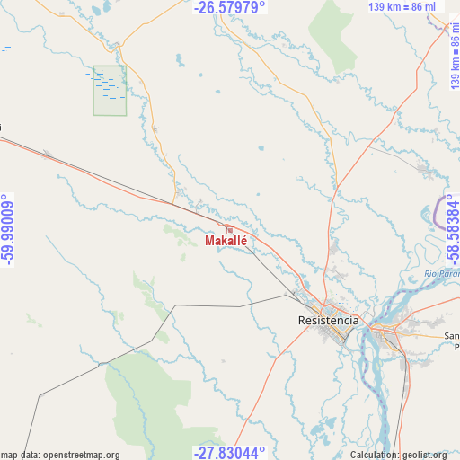
Makallé GPS coordinates[2]
27° 12' 24.732" South, 59° 17' 13.056" West
| Map corner | latitude | longitude |
|---|---|---|
| Upper-left | -26.57979°, | -59.99009° |
| Center: | -27.20687°, | -59.28696° |
| Lower-right: | -27.83044°, | -58.58384° |
| Map W x H: | 139.1×139.1 km | = 86.4×86.4mi |
| max Lat: | -21.94467° ⇑15.5% North |
| Makallé: | -27.20687° |
| min Lat: | ⇓84.5% South -54.81084° |
| min Long | Makallé | max Long |
| -72.88605° | -59.28696° | -53.64581° |
| W 73.8%⇐ | ⇒26.2% E |
Elevation
Elevation of Makallé is 67 m = 220 ft, and this is 282.3 m = 926 ft below average elevation for this country.
| Max E: |
4040 m = 13255 ft | 76.5% |
| Avg. | 349.3 m = 1146 ft | |
| Makallé | 67 m = 220 ft | |
Min E: |
-2 m = -7 ft | 23.5% |
See also: Argentina elevation on elevation.city.
Geographical zone
Makallé is located in South temperate zone (between Tropic of Capricorn and the Antarctic Circle). Distance of this Southern Tropic circle is 419.2 km =260.5 mi to North.| Distance of | km | miles | from Makallé |
|---|---|---|---|
| Equator | 3025.1 | 1879.7 | to North |
| Tropic Capricorn | 419.2 | 260.5 | to North |
| Antarctic Circle | 4376.1 | 2719.2 | to South |
| South Pole | 6981.9 | 4338.4 | to South |


Nearby cities:
15 places around Makallé: (largest is in red/bold)
• Barranqueras
45.9 km =28.5 mi,  131°
131°
• Capitán Solari
52.5 km =32.6 mi,  328°
328°
• Colonia Benítez
36.4 km =22.6 mi,  112°
112°
• Colonia Elisa
38.4 km =23.9 mi,  323°
323°
• Corrientes
53.3 km =33.1 mi,  122°
122°
• Coté-Lai
44.9 km =27.9 mi,  223°
223°
• Fontana
35 km =21.7 mi, 132°
• La Eduvigis
46.9 km =29.1 mi,  28°
28°
• La Escondida
19.4 km =12.1 mi,  304°
304°
• La Verde
12.4 km =7.7 mi, 316°
• Lapachito
11.1 km =6.9 mi, 298°
• Margarita Belén
31.7 km =19.7 mi,  101°
101°
• Puerto Tirol
27.3 km =17 mi, 132°
• Puerto Vilelas
48.5 km =30.1 mi, 134°
• Resistencia
41.1 km =25.5 mi, 133°
Sources, notices
• [Note1] Compared only with cities in Argentina existing in our database
• [Src1] Map data: © OpenStreetMap contributors (CC-BY-SA)
• [Src2] Other city data from geonames.org with taken over terms of usage.
• [Src3] Geographical zone / Annual Mean Temperature by Robert A. Rohde @ Wikipedia
