General Lavalle geodata
General Lavalle (Buenos Aires) is a seat of a second-order administrative division; located in Argentina in America/Argentina/Buenos_Aires (GMT-3) time zone. In our database, there are 785 cities with bigger population. Compared to other cities in Argentina, 83.3% of cities are located further ↑North; 92.8% of cities are located further ←West and 99.9% of cities have higher elevation than General Lavalle. Note1


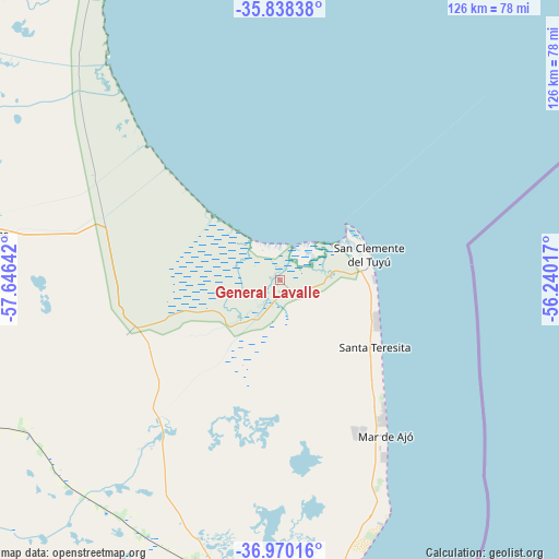
General Lavalle GPS coordinates[2]
36° 24' 22.788" South, 56° 56' 35.844" West
| Map corner | latitude | longitude |
|---|---|---|
| Upper-left | -35.83838°, | -57.64642° |
| Center: | -36.40633°, | -56.94329° |
| Lower-right: | -36.97016°, | -56.24017° |
| Map W x H: | 125.8×125.8 km | = 78.2×78.2mi |
| max Lat: | -21.94467° ⇑83.3% North |
| General Lavalle: | -36.40633° |
| min Lat: | ⇓16.7% South -54.81084° |
| min Long | General Lavalle | max Long |
| -72.88605° | -56.94329° | -53.64581° |
| W 92.8%⇐ | ⇒7.2% E |
Elevation
Elevation of General Lavalle is 3 m = 10 ft, and this is 346.3 m = 1136 ft below average elevation for this country.
| Max E: |
4040 m = 13255 ft | 99.9% |
| Avg. | 349.3 m = 1146 ft | |
| General Lavalle | 3 m = 10 ft | |
Min E: |
-2 m = -7 ft | 0.1% |
See also: Argentina elevation on elevation.city.
Geographical zone
General Lavalle is located in South temperate zone (between Tropic of Capricorn and the Antarctic Circle). Distance of this Southern Tropic circle is 1442.1 km =896.1 mi to North.| Distance of | km | miles | from General Lavalle |
|---|---|---|---|
| Equator | 4048 | 2515.3 | to North |
| Tropic Capricorn | 1442.1 | 896.1 | to North |
| Antarctic Circle | 3353.2 | 2083.6 | to South |
| South Pole | 5959.1 | 3702.8 | to South |


Nearby cities:
15 places around General Lavalle: (largest is in red/bold)
• Cariló
84.5 km =52.5 mi,  176°
176°
• Castelli
84.8 km =52.7 mi,  294°
294°
• Chascomús
133.3 km =82.8 mi,  314°
314°
• Dolores
66.7 km =41.4 mi,  278°
278°
• General Conesa
36.4 km =22.6 mi,  249°
249°
• General Guido
80.2 km =49.8 mi, 251°
• General Juan Madariaga
68 km =42.3 mi,  194°
194°
• Maipú
97.8 km =60.8 mi,  238°
238°
• Mar de las Pampas
102.4 km =63.6 mi, 183°
• Mar del Tuyú
29.5 km =18.3 mi,  129°
129°
• Pila
116.8 km =72.6 mi, 292°
• Pinamar
78.4 km =48.7 mi,  174°
174°
• San Clemente del Tuyú
20.4 km =12.7 mi,  74°
74°
• Verónica
118.7 km =73.8 mi,  342°
342°
• Villa Gesell
95.4 km =59.3 mi, 181°
Sources, notices
• [Note1] Compared only with cities in Argentina existing in our database
• [Src1] Map data: © OpenStreetMap contributors (CC-BY-SA)
• [Src2] Other city data from geonames.org with taken over terms of usage.
• [Src3] Geographical zone / Annual Mean Temperature by Robert A. Rohde @ Wikipedia
