Dolores geodata
Dolores (Buenos Aires) is a seat of a second-order administrative division; located in Argentina in America/Argentina/Buenos_Aires (GMT-3) time zone. With population of 25,190 people, there are 157 cities with bigger population in this country. Compared to other cities in Argentina, 82.7% of cities are located further ↑North; 91% of cities are located further ←West and 96.8% of cities have higher elevation than Dolores. Note1


Dolores GPS coordinates[2]
36° 18' 47.556" South, 57° 40' 45.048" West
| Map corner | latitude | longitude |
|---|---|---|
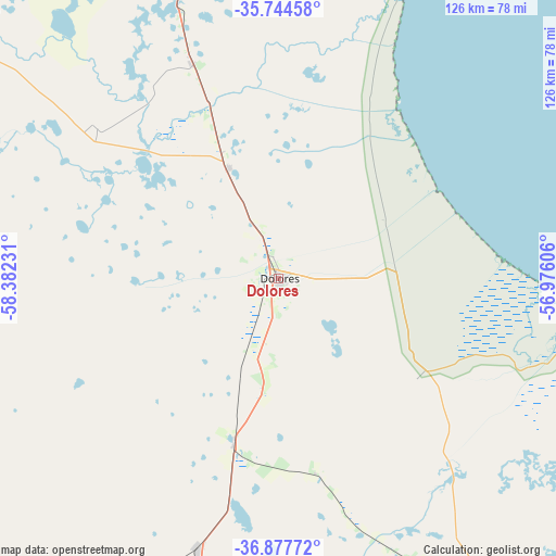
| Upper-left | -35.74458°, | -58.38231° |
| Center: | -36.31321°, | -57.67918° |
| Lower-right: | -36.87772°, | -56.97606° |
| Map W x H: | 126×126 km | = 78.3×78.3mi |
| max Lat: | -21.94467° ⇑82.7% North |
| Dolores: | -36.31321° |
| min Lat: | ⇓17.3% South -54.81084° |
| min Long | Dolores | max Long |
| -72.88605° | -57.67918° | -53.64581° |
| W 91%⇐ | ⇒9% E |
Elevation
Elevation of Dolores is 14 m = 46 ft, and this is 335.3 m = 1100 ft below average elevation for this country.
| Max E: |
4040 m = 13255 ft | 96.8% |
| Avg. | 349.3 m = 1146 ft | |
| Dolores | 14 m = 46 ft | |
Min E: |
-2 m = -7 ft | 3.2% |
See also: Argentina elevation on elevation.city.
Geographical zone
Dolores is located in South temperate zone (between Tropic of Capricorn and the Antarctic Circle). Distance of this Southern Tropic circle is 1431.7 km =889.6 mi to North.| Distance of | km | miles | from Dolores |
|---|---|---|---|
| Equator | 4037.7 | 2508.9 | to North |
| Tropic Capricorn | 1431.7 | 889.6 | to North |
| Antarctic Circle | 3363.5 | 2090 | to South |
| South Pole | 5969.4 | 3709.2 | to South |


Nearby cities:
15 places around Dolores: (largest is in red/bold)
• Ayacucho
117.8 km =73.2 mi,  217°
217°
• Castelli
27.3 km =17 mi,  335°
335°
• Chascomús
87.5 km =54.4 mi, 340°
• General Belgrano
94.9 km =59 mi,  309°
309°
• General Conesa
39.1 km =24.3 mi,  126°
126°
• General Guido
37.8 km =23.5 mi,  195°
195°
• General Juan Madariaga
90 km =55.9 mi,  147°
147°
• General Lavalle
66.7 km =41.4 mi,  98°
98°
• Maipú
63.7 km =39.6 mi, 196°
• Mar del Tuyú
93.3 km =58 mi,  108°
108°
• Pila
54.3 km =33.7 mi, 309°
• Pinamar
114.6 km =71.2 mi,  140°
140°
• Ranchos
105.7 km =65.7 mi,  326°
326°
• San Clemente del Tuyú
85.7 km =53.3 mi,  93°
93°
• Verónica
107.4 km =66.7 mi,  16°
16°
Sources, notices
• [Note1] Compared only with cities in Argentina existing in our database
• [Src1] Map data: © OpenStreetMap contributors (CC-BY-SA)
• [Src2] Other city data from geonames.org with taken over terms of usage.
• [Src3] Geographical zone / Annual Mean Temperature by Robert A. Rohde @ Wikipedia
