28 de Noviembre geodata
28 de Noviembre (Santa Cruz) is a populated place; located in Argentina in America/Argentina/Rio_Gallegos (GMT-3) time zone. With population of 4,686 people, there are 455 cities with bigger population in this country. Compared to other cities in Argentina, 99.6% of cities are located further ↑North; 99.6% of cities are located further →East and 61.5% of cities have lower elevation than 28 de Noviembre. Note1


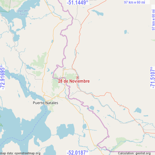
28 de Noviembre GPS coordinates[2]
51° 35' 2.04" South, 72° 12' 49.752" West
| Map corner | latitude | longitude |
|---|---|---|
| Upper-left | -51.1449°, | -72.91695° |
| Center: | -51.5839°, | -72.21382° |
| Lower-right: | -52.0187°, | -71.5107° |
| Map W x H: | 97.2×97.2 km | = 60.4×60.4mi |
| max Lat: | -21.94467° ⇑99.6% North |
| 28 de Noviembre: | -51.5839° |
| min Lat: | ⇓0.4% South -54.81084° |
| min Long | 28 de Noviembre | max Long |
| -72.88605° | -72.21382° | -53.64581° |
| W 0.4%⇐ | ⇒99.6% E |
Elevation
Elevation of 28 de Noviembre is 227 m = 745 ft, and this is 122.3 m = 401 ft below average elevation for this country.
| Max E: |
4040 m = 13255 ft | 38.5% |
| Avg. | 349.3 m = 1146 ft | |
| 28 de Noviembre | 227 m = 745 ft | |
Min E: |
-2 m = -7 ft | 61.5% |
See also: Argentina elevation on elevation.city.
Geographical zone
28 de Noviembre is located in South temperate zone (between Tropic of Capricorn and the Antarctic Circle). Distance of this South polar circle is 1665.6 km =1035 mi to South.| Distance of | km | miles | from 28 de Noviembre |
|---|---|---|---|
| Equator | 5735.6 | 3563.9 | to North |
| Tropic Capricorn | 3129.7 | 1944.7 | to North |
| Antarctic Circle | 1665.6 | 1035 | to South |
| South Pole | 4271.5 | 2654.2 | to South |


Nearby cities:
7 places around 28 de Noviembre: (largest is in red/bold)
• Comandante Luis Piedra Buena
292.2 km =181.6 mi,  52°
52°
• El Calafate
138.3 km =85.9 mi,  358°
358°
• El Chaltén
255.1 km =158.5 mi,  349°
349°
• Gobernador Gregores
344.7 km =214.2 mi,  23°
23°
• Río Gallegos
206.9 km =128.6 mi,  91°
91°
• Río Turbio
10 km =6.2 mi,  302°
302°
• Yacimiento Río Turbio
9.5 km =5.9 mi,  277°
277°
Sources, notices
• [Note1] Compared only with cities in Argentina existing in our database
• [Src1] Map data: © OpenStreetMap contributors (CC-BY-SA)
• [Src2] Other city data from geonames.org with taken over terms of usage.
• [Src3] Geographical zone / Annual Mean Temperature by Robert A. Rohde @ Wikipedia
