Río Gallegos geodata
Río Gallegos (Santa Cruz) is a seat of a first-order administrative division; located in Argentina in America/Argentina/Rio_Gallegos (GMT-3) time zone. With population of 85,700 people, there are 48 cities with bigger population in this country. Compared to other cities in Argentina, 99.7% of cities are located further ↑North; 95.2% of cities are located further →East and 96.2% of cities have higher elevation than Río Gallegos. Note1


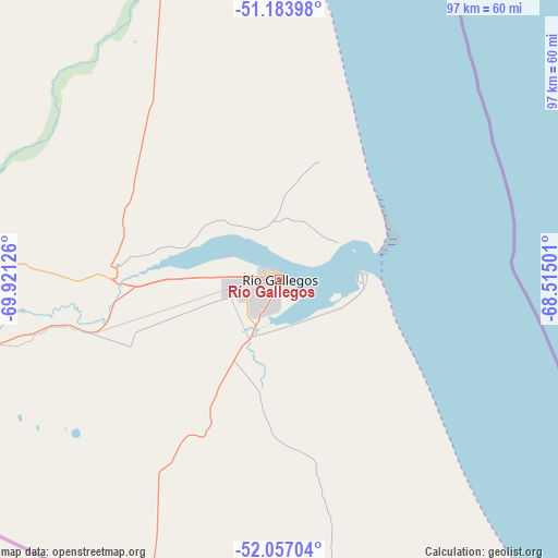
Río Gallegos GPS coordinates[2]
51° 37' 21.396" South, 69° 13' 5.268" West
| Map corner | latitude | longitude |
|---|---|---|
| Upper-left | -51.18398°, | -69.92126° |
| Center: | -51.62261°, | -69.21813° |
| Lower-right: | -52.05704°, | -68.51501° |
| Map W x H: | 97.1×97.1 km | = 60.3×60.3mi |
| max Lat: | -21.94467° ⇑99.7% North |
| Río Gallegos: | -51.62261° |
| min Lat: | ⇓0.3% South -54.81084° |
| min Long | Río Gallegos | max Long |
| -72.88605° | -69.21813° | -53.64581° |
| W 4.8%⇐ | ⇒95.2% E |
Elevation
Elevation of Río Gallegos is 15 m = 49 ft, and this is 334.3 m = 1097 ft below average elevation for this country.
| Max E: |
4040 m = 13255 ft | 96.2% |
| Avg. | 349.3 m = 1146 ft | |
| Río Gallegos | 15 m = 49 ft | |
Min E: |
-2 m = -7 ft | 3.8% |
See also: Río Gallegos elevation on elevation.city.
Geographical zone
Río Gallegos is located in South temperate zone (between Tropic of Capricorn and the Antarctic Circle). Distance of this South polar circle is 1661.3 km =1032.3 mi to South.| Distance of | km | miles | from Río Gallegos |
|---|---|---|---|
| Equator | 5739.9 | 3566.6 | to North |
| Tropic Capricorn | 3134 | 1947.4 | to North |
| Antarctic Circle | 1661.3 | 1032.3 | to South |
| South Pole | 4267.2 | 2651.5 | to South |


Nearby cities:
11 places around Río Gallegos: (largest is in red/bold)
• 28 de Noviembre
206.9 km =128.6 mi,  271°
271°
• Comandante Luis Piedra Buena
183.3 km =113.9 mi,  6°
6°
• El Calafate
257.2 km =159.8 mi,  303°
303°
• Gobernador Gregores
327.6 km =203.6 mi,  347°
347°
• Puerto Santa Cruz
184.9 km =114.9 mi,  15°
15°
• Río Grande
261.3 km =162.4 mi,  157°
157°
• Río Turbio
215.7 km =134 mi, 272°
• San Julián
278.4 km =173 mi, 22°
• Tolhuin
348.4 km =216.5 mi, 157°
• Ushuaia
359.5 km =223.4 mi,  170°
170°
• Yacimiento Río Turbio
216.4 km =134.5 mi, 271°
Sources, notices
• [Note1] Compared only with cities in Argentina existing in our database
• [Src1] Map data: © OpenStreetMap contributors (CC-BY-SA)
• [Src2] Other city data from geonames.org with taken over terms of usage.
• [Src3] Geographical zone / Annual Mean Temperature by Robert A. Rohde @ Wikipedia
