Comandante Luis Piedra Buena geodata
Comandante Luis Piedra Buena (Santa Cruz) is a populated place; located in Argentina in America/Argentina/Rio_Gallegos (GMT-3) time zone. With population of 4,176 people, there are 481 cities with bigger population in this country. Compared to other cities in Argentina, 99.1% of cities are located further ↑North; 94.2% of cities are located further →East and 97.3% of cities have higher elevation than Comandante Luis Piedra Buena. Note1
Current local time in Comandante Luis Piedra Buena:
05:31 AM, SaturdayDifference from your time zone: hours


Comandante Luis Piedra Buena GPS coordinates[2]
49° 59' 6.468" South, 68° 54' 52.812" West
| Map corner | latitude | longitude |
|---|---|---|
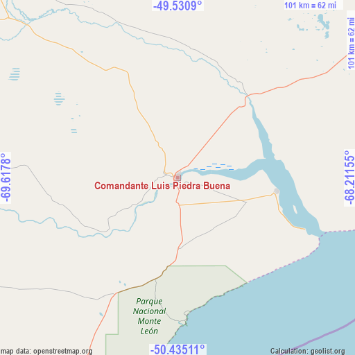
| Upper-left | -49.5309°, | -69.6178° |
| Center: | -49.98513°, | -68.91467° |
| Lower-right: | -50.43511°, | -68.21155° |
| Map W x H: | 100.5×100.5 km | = 62.4×62.4mi |
| max Lat: | -21.94467° ⇑99.1% North |
| Comandante Luis Piedra Buena: | -49.98513° |
| min Lat: | ⇓0.9% South -54.81084° |
| min Long | Comandante Luis | max Long |
| -72.88605° | -68.91467° | -53.64581° |
| W 5.8%⇐ | ⇒94.2% E |
Elevation
Elevation of Comandante Luis Piedra Buena is 12 m = 39 ft, and this is 337.3 m = 1107 ft below average elevation for this country.
| Max E: |
4040 m = 13255 ft | 97.3% |
| Avg. | 349.3 m = 1146 ft | |
| Comandante Luis Piedra Buena | 12 m = 39 ft | |
Min E: |
-2 m = -7 ft | 2.7% |
See also: Argentina elevation on elevation.city.
Geographical zone
Comandante Luis Piedra Buena is located in South temperate zone (between Tropic of Capricorn and the Antarctic Circle). Distance of this South polar circle is 1843.3 km =1145.4 mi to South.| Distance of | km | miles | from Comandante Luis Piedra Buena |
|---|---|---|---|
| Equator | 5557.8 | 3453.5 | to North |
| Tropic Capricorn | 2951.9 | 1834.2 | to North |
| Antarctic Circle | 1843.3 | 1145.4 | to South |
| South Pole | 4449.2 | 2764.6 | to South |


Nearby cities:
14 places around Comandante Luis Piedra Buena: (largest is in red/bold)
• 28 de Noviembre
292.2 km =181.6 mi,  232°
232°
• Caleta Olivia
407.4 km =253.1 mi,  14°
14°
• El Calafate
242.7 km =150.8 mi,  260°
260°
• Gobernador Gregores
167.8 km =104.3 mi,  324°
324°
• Las Heras
382.9 km =237.9 mi,  359°
359°
• Perito Moreno
405.8 km =252.2 mi,  338°
338°
• Pico Truncado
361.7 km =224.7 mi, 11°
• Puerto Deseado
332.5 km =206.6 mi,  41°
41°
• Puerto Santa Cruz
28.2 km =17.5 mi,  97°
97°
• Río Gallegos
183.3 km =113.9 mi,  186°
186°
• Río Grande
430.8 km =267.7 mi,  168°
168°
• Río Turbio
296 km =183.9 mi, 234°
• San Julián
114.1 km =70.9 mi,  48°
48°
• Yacimiento Río Turbio
299.2 km =185.9 mi, 233°
Sources, notices
• [Note1] Compared only with cities in Argentina existing in our database
• [Src1] Map data: © OpenStreetMap contributors (CC-BY-SA)
• [Src2] Other city data from geonames.org with taken over terms of usage.
• [Src3] Geographical zone / Annual Mean Temperature by Robert A. Rohde @ Wikipedia
